Last updated on 4/7/24
View My Guestbook
Sign My Guestbook

Last updated on 4/7/24
Site established on 3/22/01
|
|
Places & Bases
| Click here to see maps of South East Asia | ||
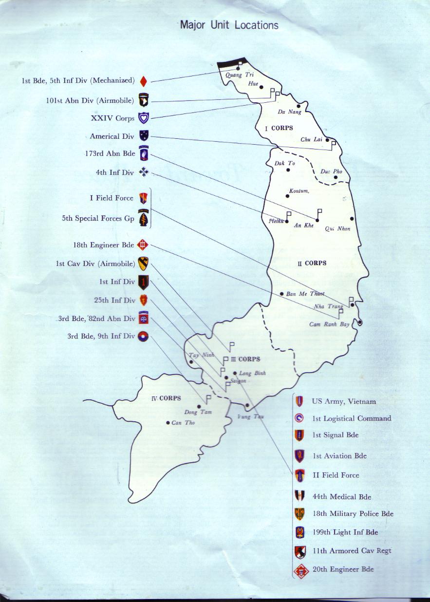
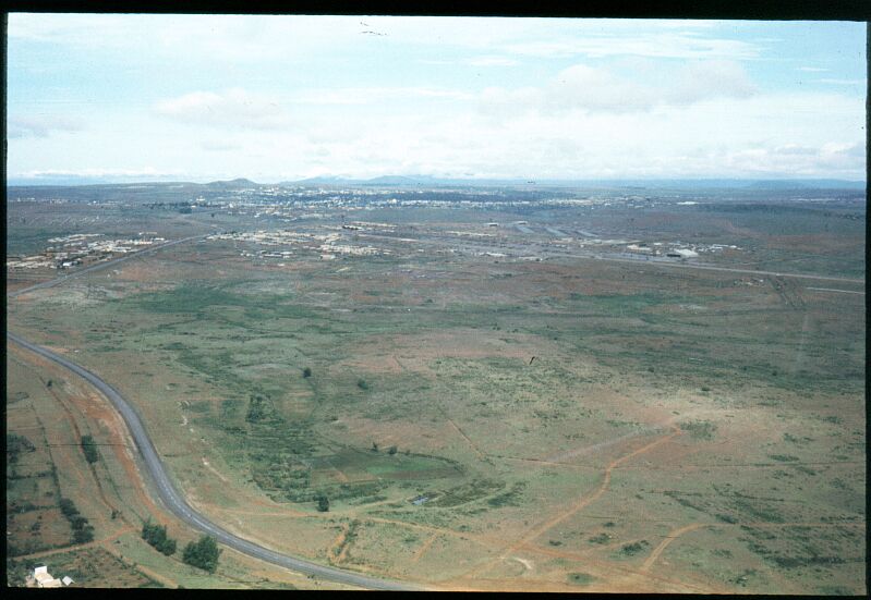
Map of Vietnam with major unit locations |
||
Camp Halloway... outside Pleiku image courtesy of Steve Shepard, C troop 7/17 |
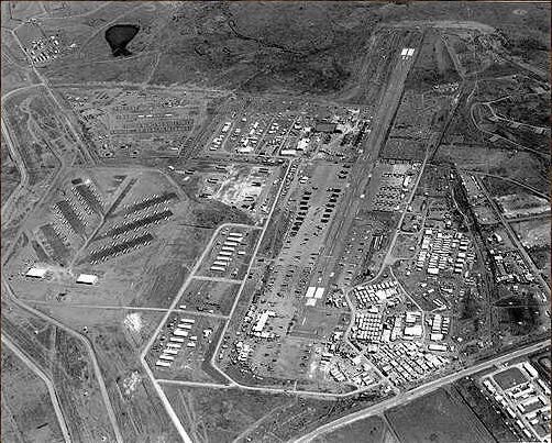
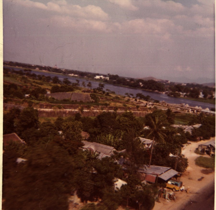
An Son, Vietnam image courtesy of Steve Shepard - taken late July of 1972 |

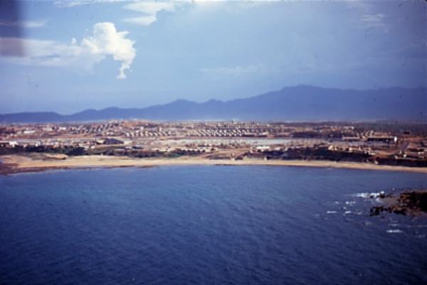
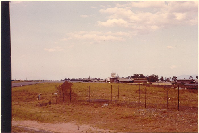
Cam Ranh Bay |

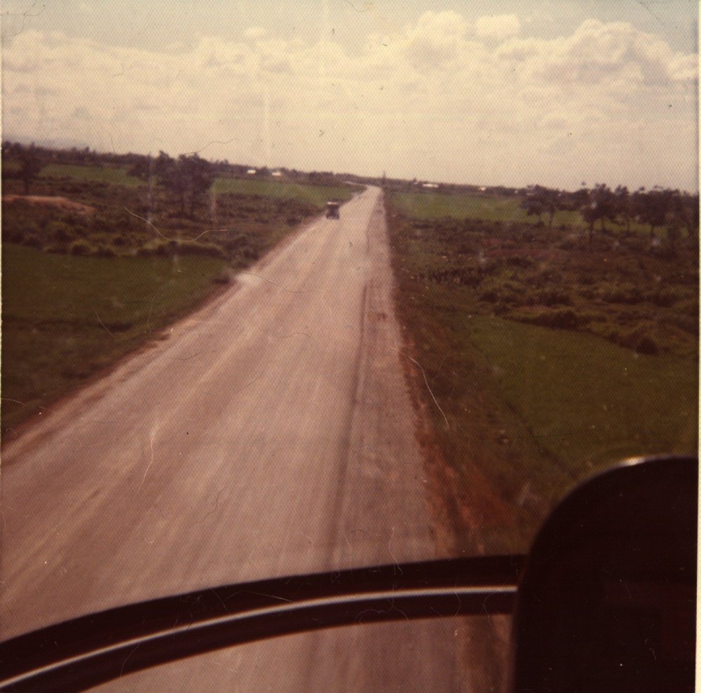
Oh Shit!� This is NOT the place to be stopped.� East Bound from Pleiku to QuiNhon, truck on the An Khe pass loses its brakes, takes a curve too fast and overturns....� This is, most certainly, a VERY bad development image courtesy of Steve Shepard |
CW2 Steve Shepard on the runway at LZ crystal. Crystal was located on Hwy 1 about half way between Phu Cat AFB and LZ English... all in Bin Dihn Provence North of Qui Nhon image courtesy of Steve Shepard |
Chu Lai from the air image courtesy of Dan Delor F/8 |
Two views of Camp Eagle looking east toward Hill 180 and Phu Bai, from 2/17th Cav area. Dong Truoi mtn. faintly visible on right in the distance. image courtesy of Doug Kibbey |
2/17 Cav. HQ trp flight line at Camp Eagle. image courtesy of Doug Kibbey |
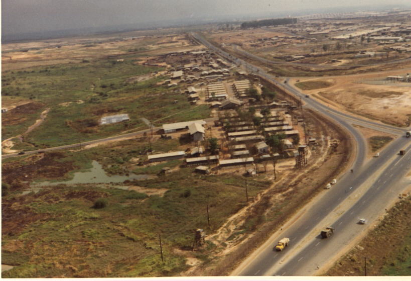
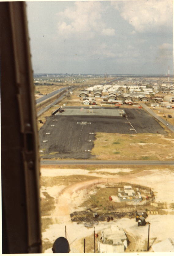
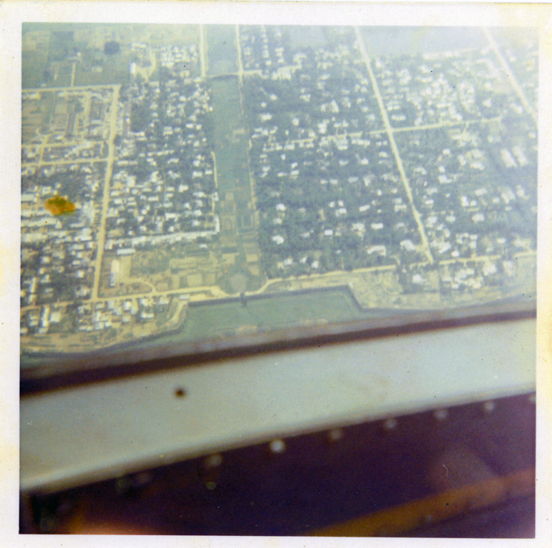
An aerialshot from the east looking west at the 90th Replacement Detachment on the NW corner of Long Binh image courtesy of Jay Brown |
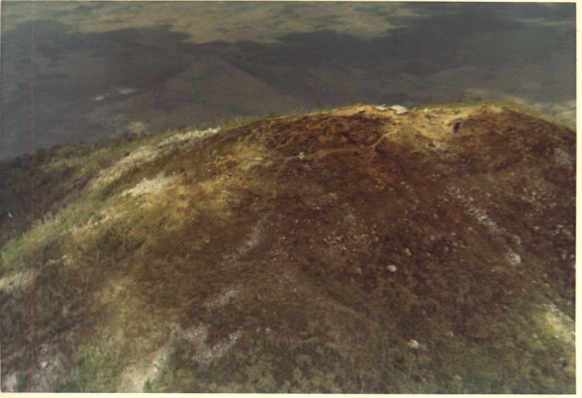
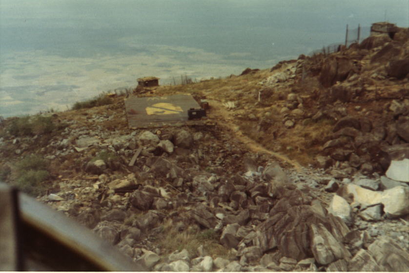
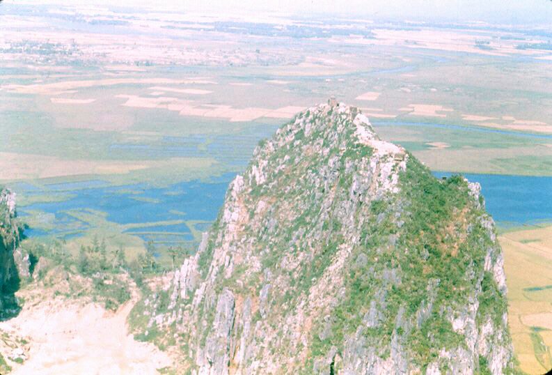
Nui Ba Dinh shows the site on top of the Black Virgin Mountain. The low pad can be seen at the 8 o'clock position from the top of the hill. The upper pad is, if memory serves, is at 3 o'clock from the top of the hill image courtesy of Jay Brown |
"Planta is on short final to either Plantation or Red Carpet in Long Binh. My brain cells are shouting Red Carpet but I just don't trust 'em anymore." - Jay Brown image courtesy of Jay Brown |
"Lowpad shows the secondary pad atop Nui Ba Dinh or Black Virgin Mountain from short final. That was an interesting approach." Jay Brown HHT 3/17 image courtesy of Jay Brown |
"The view of Long Binh from my hootch". Jay Brown HHT 3/17 image courtesy of Jay Brown |
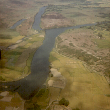
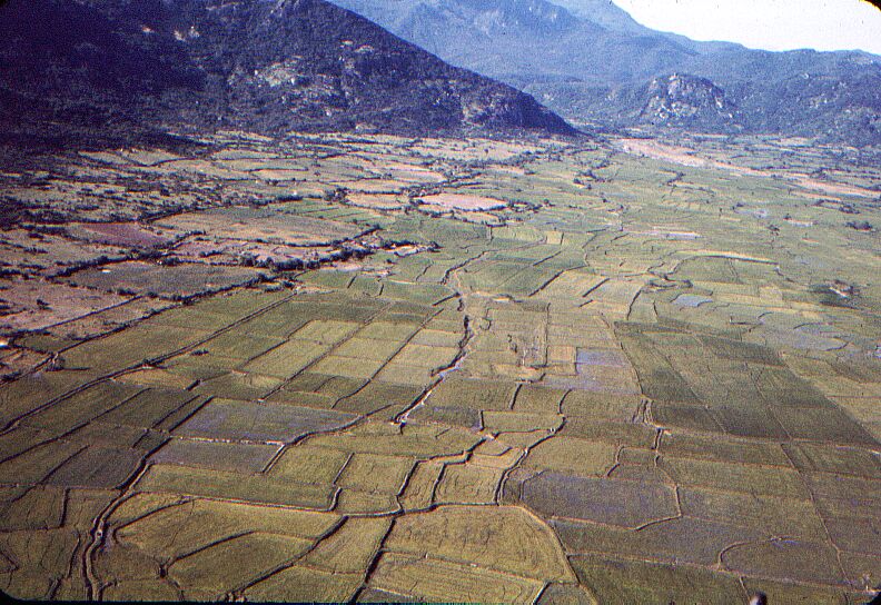
Song Thu Bon River, "Arizona Territory" - The TAOR ( Tactical Area Of Responsibility ) of the First Battalion First Marine Regiment First Marine Division after we returned from Operation Hastings on the DMZ in 1966 , was just south of Da Nang , ran along the coast south to Hoi An , and inland . "Arizona Territory : was part of the inland area......mostly rice paddies , bamboo hedge rows which were a bitch , and small Viet villes ( villages ) . Pretty much 100 % VC and / or VC Sympathizers.........photo shows patrol along typical trail , with hedge rows to right ....when I was there in 66 - 67 we stayed OFF the trails as the entire area was heavily booby trapped . image courtesy of Gordon Boswell, Cpl USMC, Delta Company, 1ST BN 1ST Marines 1st Mar Div - Winter of 69 via Tim Sloat |

An Khe POL Sign,� it is hard to read but anyone that refueled at An Khe will remember it. It reads "Super Shell with Platformate will get you places that you don' even want to go". image courtesy of Jim Beach, 61st AHC |

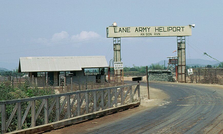
Lane AHP(An Son) this is the other side of the hill from the main gate. image courtesy of Jim Beach, 61st AHC |
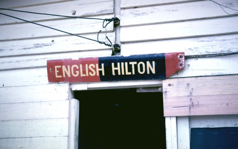
English Hilton, were the gunnies lived at LZ English image courtesy of Jim Beach, 61st AHC |
This is "The Morgue" B Troop's (7/17) Camp at Phan Thiet from July'68- mid '69. This photo was taken about August of '68. image courtesy of Richard J Hefferman, B Troop 7th Sqn 17th Cav Reg (Air) |
This is a photo of B Troop's Company area looking south towards the airlield at Camp Enari Pleiku early '68. image courtesy of Richard J Hefferman, B Troop 7th Sqn 17th�Cav Reg (Air) |
Airfield at Soc Trang - C troop, 16th Cav image courtesy of Woody Mashburn |
"Mission Above All" Big Red One at Di An (pronounced Zeon) was the Div rear and HQ for the 1/4 CAV squadron.� Southeast of Phu Loi about 20. image courtesy of "Woody" Mashburn & Hugh Mills |
Ft. Wolters Texas May 1969 Pre Flight Area Image courtesy of Felix Bates 240th AHC BearCat�4/70-�11/71 |
III Corps Tactical Zone HQ Bien Hoa RVN |
MACV HQ - Aug '68 |
LZ English |

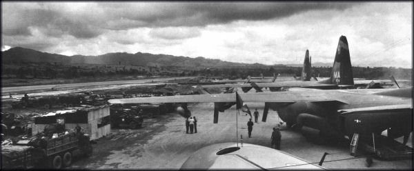
C-130 Airstrip Bao Loc RVN '67 |
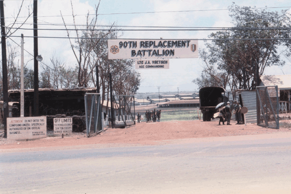
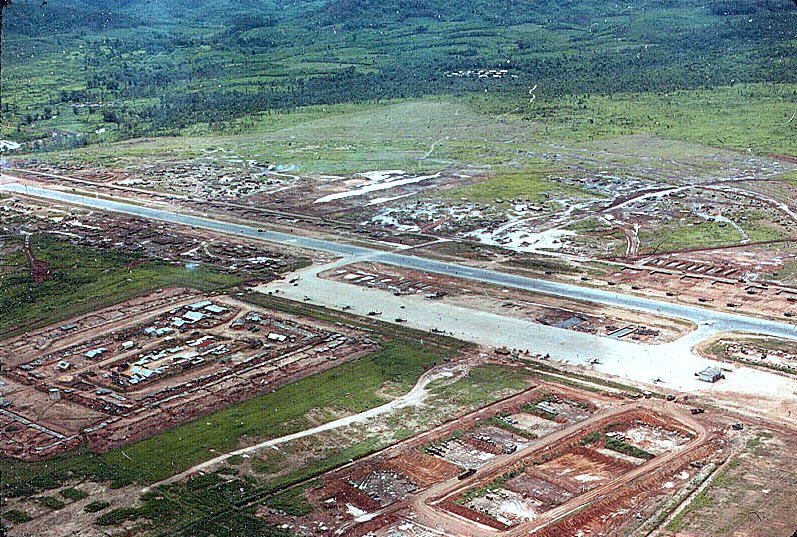
90th Replacement Battalion 1968 |
Fire base a couple miles North of Phan Rang Image courtesy of Steve Shepard |
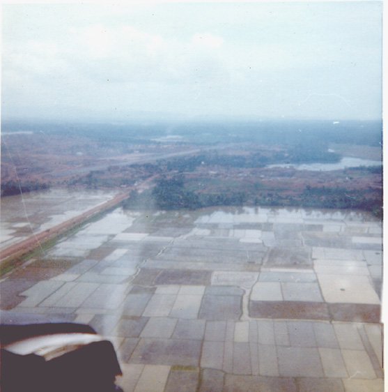
This is a small coastal plain South of Cam Ranh Bay - 3 Nov 71. Taken from the back of a Huey enroute to Phan Rang Image courtesy of Steve Shepard |
Bong Son from a Cobra Image courtesy of Steve Shepard |
Holloway Tower |
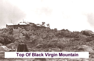
Image courtesy of Bill Hughes via Egor |
Image courtesy of Bill Hughes via Egor |
Image courtesy of Bill Hughes via Egor |
Image courtesy of Bill Hughes via Egor |
Image courtesy of Bill Hughes via Egor |
Image courtesy of Bill Hughes via Egor |
Image courtesy of Bill Hughes via Egor |
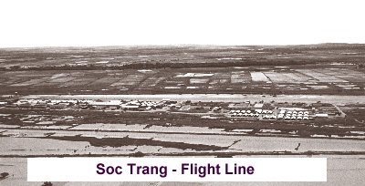
Image courtesy of Bill Hughes via Egor |
Image courtesy of Bill Hughes via Egor |
Image courtesy of Bill Hughes via Egor |
Image courtesy of Bill Hughes via Egor |
Image courtesy of Bill Hughes via Egor |
Image courtesy of Bill Hughes via Egor |

South East of Pleiku.......� Central Highlands, beautiful country! Image courtesy of Steve Shepard |
Hwy 19 looking west toward Holloway. March 72. Pleiku is in the background" Image courtesy of Steve Shepard |
Soc Trang air field Image courtesy of Don "RAC" Raczon 336th AHC |
This is The Bridge on the River Kwai. The building to the right of the bridge is a Bar. This is near Konchenoburi, Thailand where we assisted the 46th Special Forces Company in training "The Queen's Cobras". A Thai Division deployd to Vietnam. Image courtesy of Joe Frey - 7th Airlift Platoon |
This is the Army Ramp at Camp Friendship Korat (KRT) Thailand. It is next to Korat, US Air Force Base, notice the F-105, in the background, departing for North Vietnam. The Air Force Base was concrete and asphalt, Camp Friendship was Pierced & Nonpierced Planking and Dirt Image courtesy of Joe Frey - 7th Airlift Platoon |
Phu Bai airport terminal with RVN flag Image courtesy of Doug Kibbey |
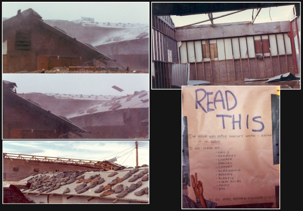
Roof coming off the combination "D"Trp.,2/17th Cav. and "L" Co. Ranger Hangar, & aftermath of combo of Typhoon Agnes & Supertyphoon Bess that struck Asia between 18-21 Sept. '71. Seems to have affected Supply Room morale adversely Image courtesy of Doug Kibbey |

Needless to say the rainy season sucked at the Golf Course .... RVN September 1965 (An Khe) Image courtesy of Ed Lemp |
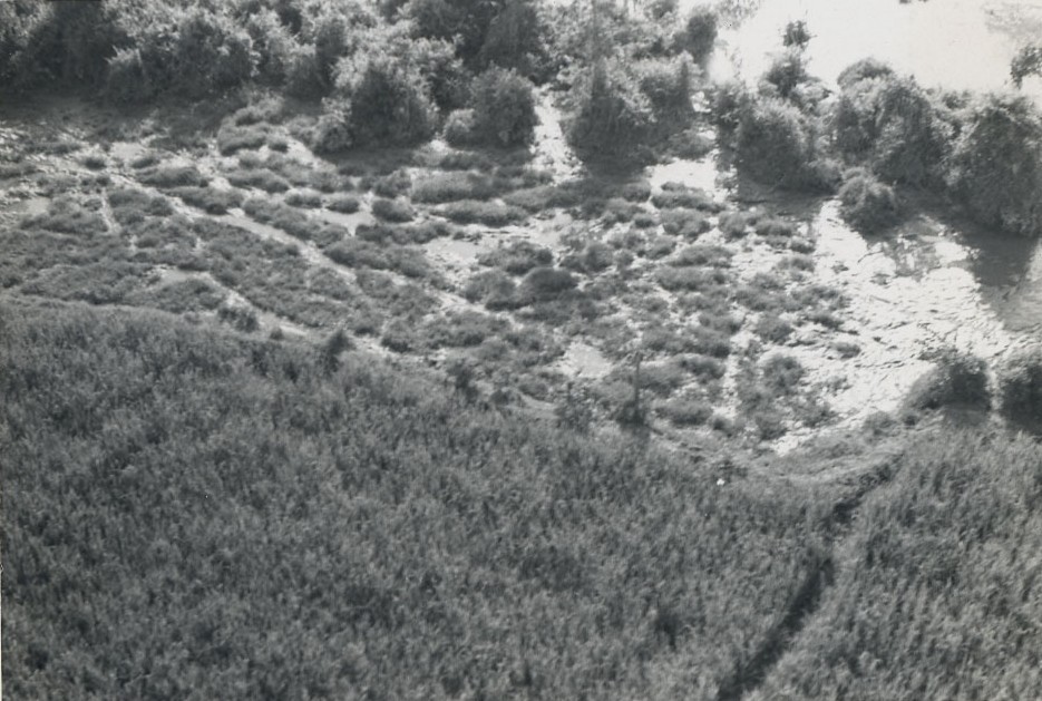
Aerial view of convergence of two enemy trails (& a perfect spot to set an ambush). Taken in I Corps, area of Thua Thien/Quang Tri provinces. Image courtesy of Doug Kibbey |
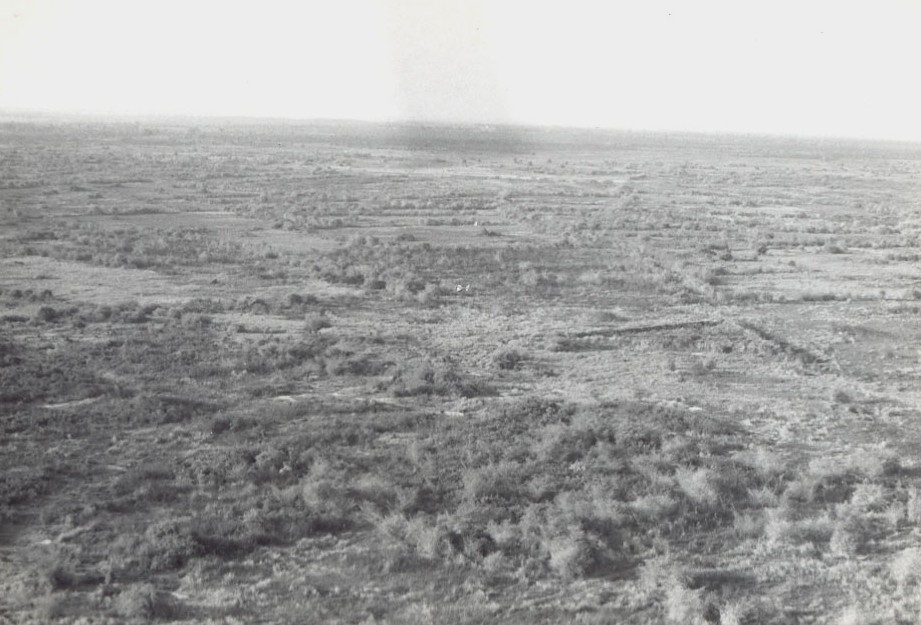
Aerial shot taken while scouting in I Corps...look closely and you will see another recon helicopter in the exact center of the picture beneath the "shadow" of the rotor blade passing overhead. Taken in I Corps, area of Thua Thien/Quang Tri provinces. Image courtesy of Doug Kibbey |
Photo from�1970 Winter�issue of the 1st Cavalry division magazine "The First Team" Image courtesy of Mike O'Neil |

Debarking the USS Boxer in Qui Nhon bay...September 10, 1965 Image courtesy of Ed Lemp |
In the landing craft getting ready to head for the beach at Qui Nhon Image courtesy of Ed Lemp |
Our first bunker at the Golf Course...E 82nd area. Sp4 Lybert digging. Image courtesy of Ed Lemp |
Getting ready to board an Air Force C-123 at An Khe airstrip. Heading to Nha Trang for RNR.�10/65 Image courtesy of Ed Lemp - Btry E, 82nd Arty� |
1st Cav Mohawk landing at An Khe airstrip ... Hon Cong mountain in background. 10/65 Image courtesy of Ed Lemp - Btry E, 82nd Arty� |
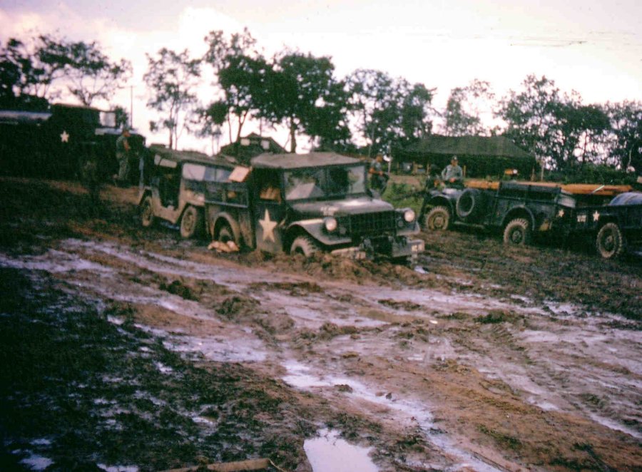
Mud at the Golf Course Image courtesy of Ed Lemp - Btry E, 82nd Arty� |

Dong Truoi mountain, view south from Phu Bai. Image courtesy of Doug Kibbey |
On top of Hon Cong mountain at the Golf Course...looking west Image courtesy of Ed Lemp |
Phu Cat SF Camp airstrip 10/65 ... before it was a big airbase Image courtesy of Ed Lemp |
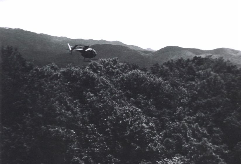
An H/17th Cav OH-6 was taken in late 1972 in the Central Highlands north and west of Pleiku near infamous, "Rocket Ridge," so named for obvious reasons. Image courtesy of Bob Hesselbein, Undertaker 27 |
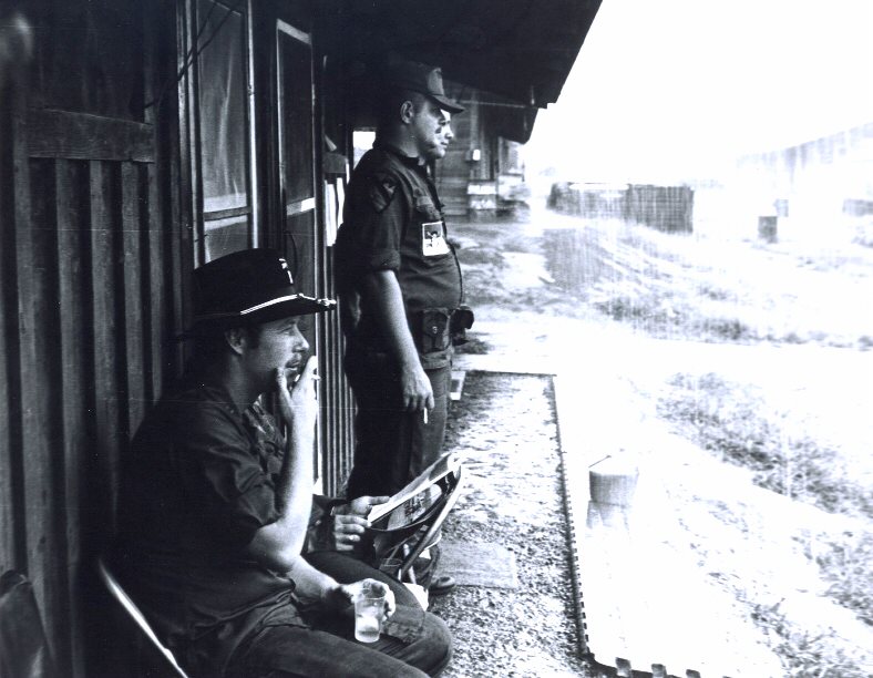
H/17th pilots outside their quarters, grounded by monsoon conditions at Camp Holloway, Pleiku, 1972 Image courtesy of Bob Hesselbein, Undertaker 27 |
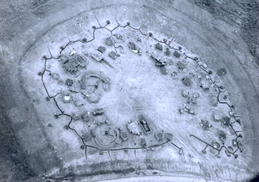
A Central Highland Firebase. This picture was taken in Novermber, 1972 from H/17th Cav cobra overhead a firebase guarding the infamous Mang Yang Pass. Note 105 howitzers and mortars in sandbagged positions. Perimeter trenches and bunkers are noticeable along with barb wire concertinas surrounding the fortification. - Steve Sheppard has identified this as LZ ACTION Image courtesy of Bob Hesselbein, Undertaker 27 |
A picture of a big rock in my troop area at Phu Bai Image courtesy of Jim Newman - Condor 6 C troop, 2/17 |
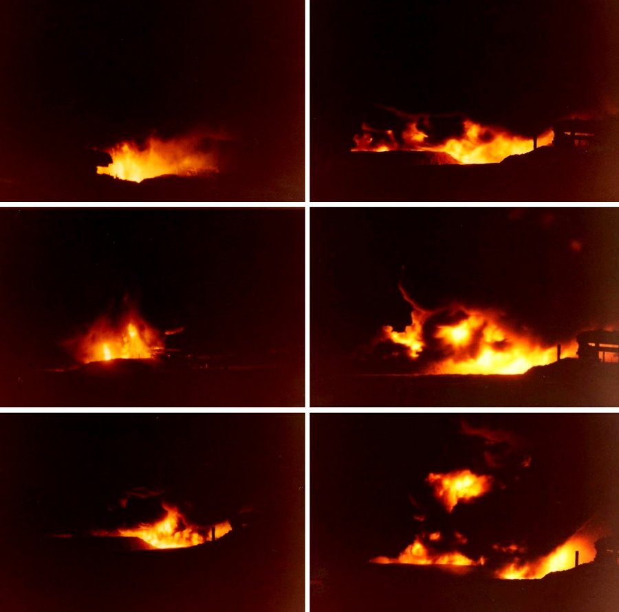
Firebase Fiddler's Green, Hau Nghia Province, 1972. This sequence shows what happens when your POL point gets rocketed. Image courtesy of Doug Kibbey |

Lam Son 719 - January 30 - April 6 1971 Image courtesy of Jim Newman - Condor 6,�C troop 2/17 Cav |
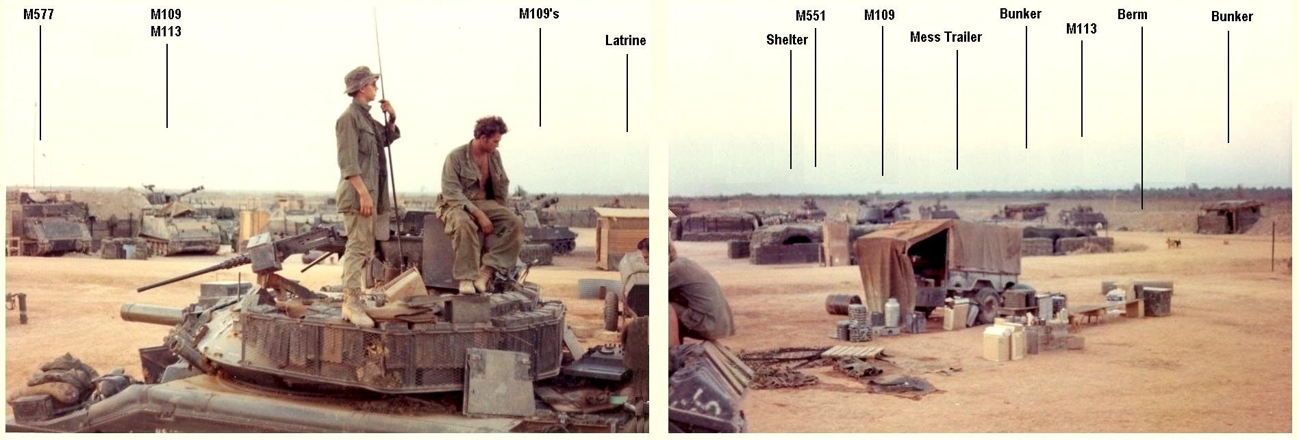
Anatomy of a Firebase...FSB Fiddler's Green, Hau Nghia province '72. M577 is Command Car version of M113, M109's are self-propelled 155mm Howitzers of Howitzer Battery (and the reason-for-being of the Firebase), Berm is the earthworks perimeter wall, Mess trailer accompanied the Cav troop in the field (away from the Firebase), and the vehicle in foreground is an M551 under repair. Bunkers are perimeter fighting positions around the berm, Shelters are 'in-board' of the berm and protection against incoming artillery. Image courtesy of Doug Kibbey, Cmdr., HQ71, M113 A CAV, "G"Trp., 2/11 ACR |
Dam I loved it. Didn't you? Again in the Delta Image courtesy of Lowell L. Eneix |

Guess who? post 68 tet. Yes that's me it is an SF's outpost I think west and a little north of Saigon - Lowell L. Eneix Image courtesy of CWO2 Lowell L. Eneix A 101 COMANCHEROS 71-72 zorba 121st AHC SOCTRANG TIGERS 67-68 WRECKER2 67-11 A-3 1st woc |

A special forces memorial up around the iron triangle. Image courtesy of Lowell L. Eneix |

A strip near the border. 3 sisters area. Supposedly these people went into villages to start schools, hospitals. etc. kinda sneaky pete stuff too. Image courtesy of Lowell L. Eneix |
|
Combat Tracker. The only dog killed in VN was one working with "C" Troop & Mac. Image courtesy of Jim Newman |
.jpg)
Image courtesy of Frank Zipperer 118th Avn Mar 64- Mar65 |

This is the best shot I have of the statue at Vung Tau. 67-68 era Image courtesy of Lowell L. Eneix |
Tower at Soc Trang Image courtesy of Forrest L. Webb |
Sign of the times, Army chapel in Long Binh-1972 Image courtesy of Doug Kibbey |
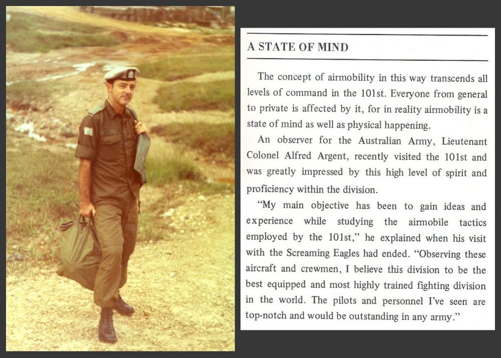
ID of Lt.Col. Argent confirmed. I took this picture at Camp Eagle in the 2/17th Cav area in '71 and recently found the text of his interview in an article on airmobility in the Summer/Fall '71 issue of Rendezvous With Destiny, the periodical of the 101st Airborne Div. in Vietnam. There was another Aussie, a flight surgeon I think, who visited us with an assistant at D Troop, 2/17th Cav and taught us to rappel 'Australian style'...head first, but his name really escapes me." - Doug Kibbey, D Trp.,2/17th Cav., 101st Abn. Image courtesy of Doug Kibbey |
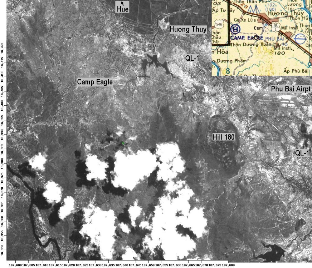
Satellite photo of the Phu Bai - Camp Eagle area of MR1. More recent image of same area, with JOG map image superimposed. Image courtesy of Doug Kibbey |
A SF compound 15 min north of Can Tho at 80 knots. 67-68 era. Image courtesy of Lowell L. Eneix |
Camp Eagle 1969 - "I can identify this view as being taken from the "L" Co. Rangers area pad looking toward the "D" trp.,2/17th Cav area and the shared hangar area. The hangar in the background is the same one (viewed from the other side) that can be seen with its roof being blown off during the combination of Typhoon Agnes & super Typhoon Bess in Sept.'71 shown elsewhere on this website, in this section. The "D" troop mess hall can be seen at the top of the hill immediately above the hovering UH-1" -Doug Kibbey Image courtesy of Sonny Sontag photo via Randy White |
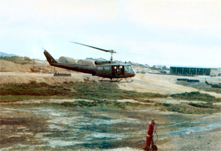
LZ Sally - The Troop and 507th TC Det was located on LZ Sally prior to moving to Phu Bai. Image courtesy of Jim Newman |
Phu Bai - LZ Sally, Just like Downtown. Got a monsoon moving in on the left Image courtesy of Jim Newman |

Camp Eagle Image courtesy of Jim Newman |
FSB Birmingham viewed from North side ('71), foreground gunjeeps are 'D' Trp.,2/17th Cavalry. 175mm rifles are lowered & not visible. Runway is to left (east), Song Huu river behind the hill. Perspective error prevents a proper panoramic, but if you use your imagination... Image courtesy of Doug Kibbey, 'D' Troop, 2/17th Cav |

NDP in Hau Nghia province '72. A totally black night illuminated only by rocket flare, sufficient to permit color exposures. This is the same NDP viewable in different circumstances in the Weapons section elsewhere on this website. View is from outer perimeter across the center, & the angle is identical to the last of the 4 frame composite in Weapons. Smoke hanging in the right frame is from gunfire Image courtesy of Doug Kibbey, Cmdr G-71 ACAV, 'G' Troop, 2/11th ACR |
Composite of 2 satellite views & JOG map of FSB Birmingham & relative position Image courtesy of Doug Kibbey |
View from lower level at FSB Birmingham. 175mm impacts can be seen in two distinct areas about 12 clicks out. The two specks in the air at left aren't artifacts, but aircraft...& yes, it is dangerous, aircraft are sometimes hit by artillery rounds in flight (there are pics of a CH-47 pierced by a 105mm on the 'Heli-Vets' site, I believe...it survived) Image courtesy of Doug Kibbey |
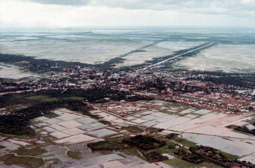
The top picture is Soc Trang airfield, the bottom is the city of Soc Trang (Khan Hung, to the Viet Namese) Image courtesy of Donald Jackson |
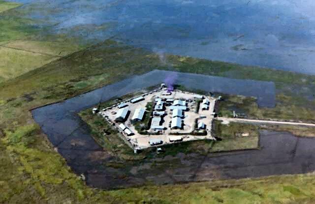
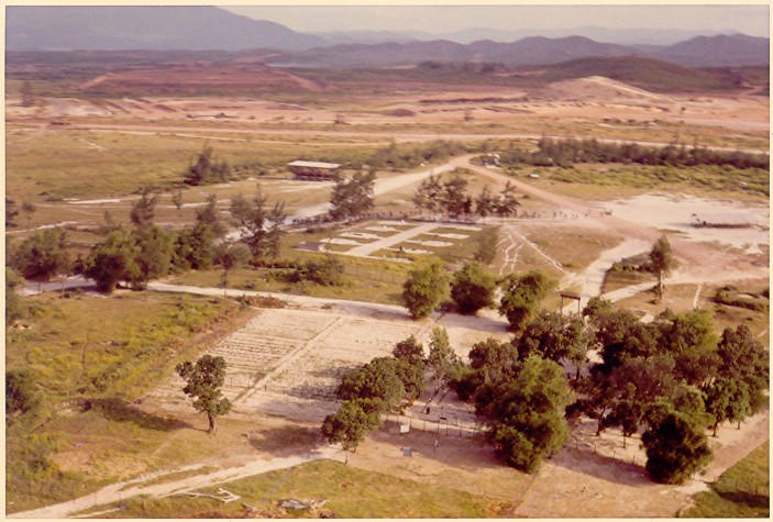
Camp Alpha Image courtesy of Robert Geiger |

Composite Aeronautical map, from Quang Tri to Chu Lai. An exercise in creative resize-cut-&-paste 'lifted' from about 4 different sources, plus some drawing to fill in blank areas. Image courtesy of Doug Kibbey |
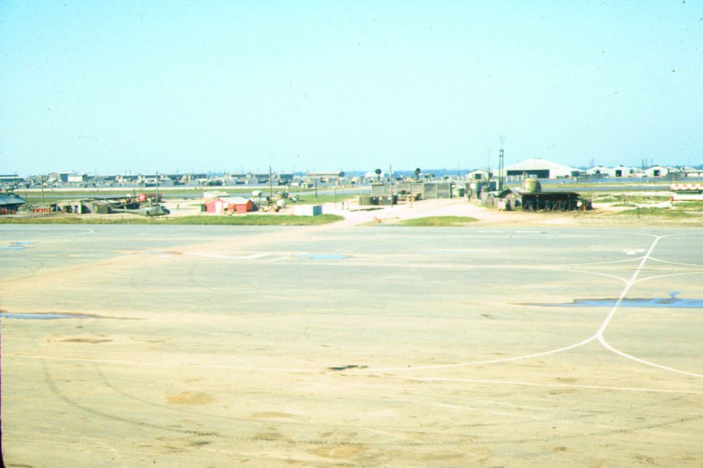
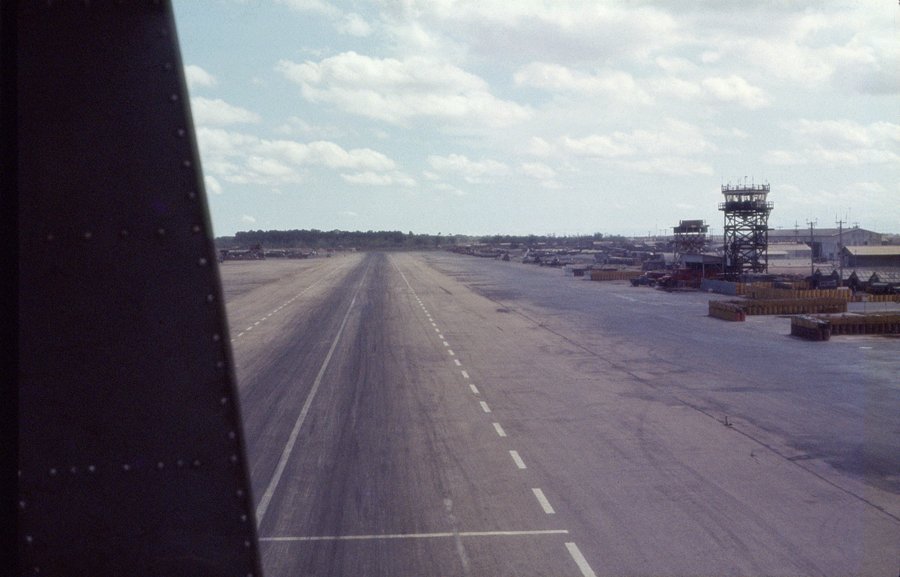
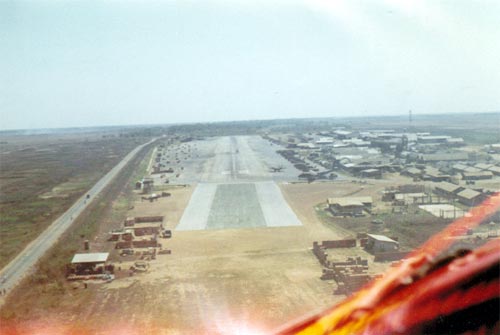
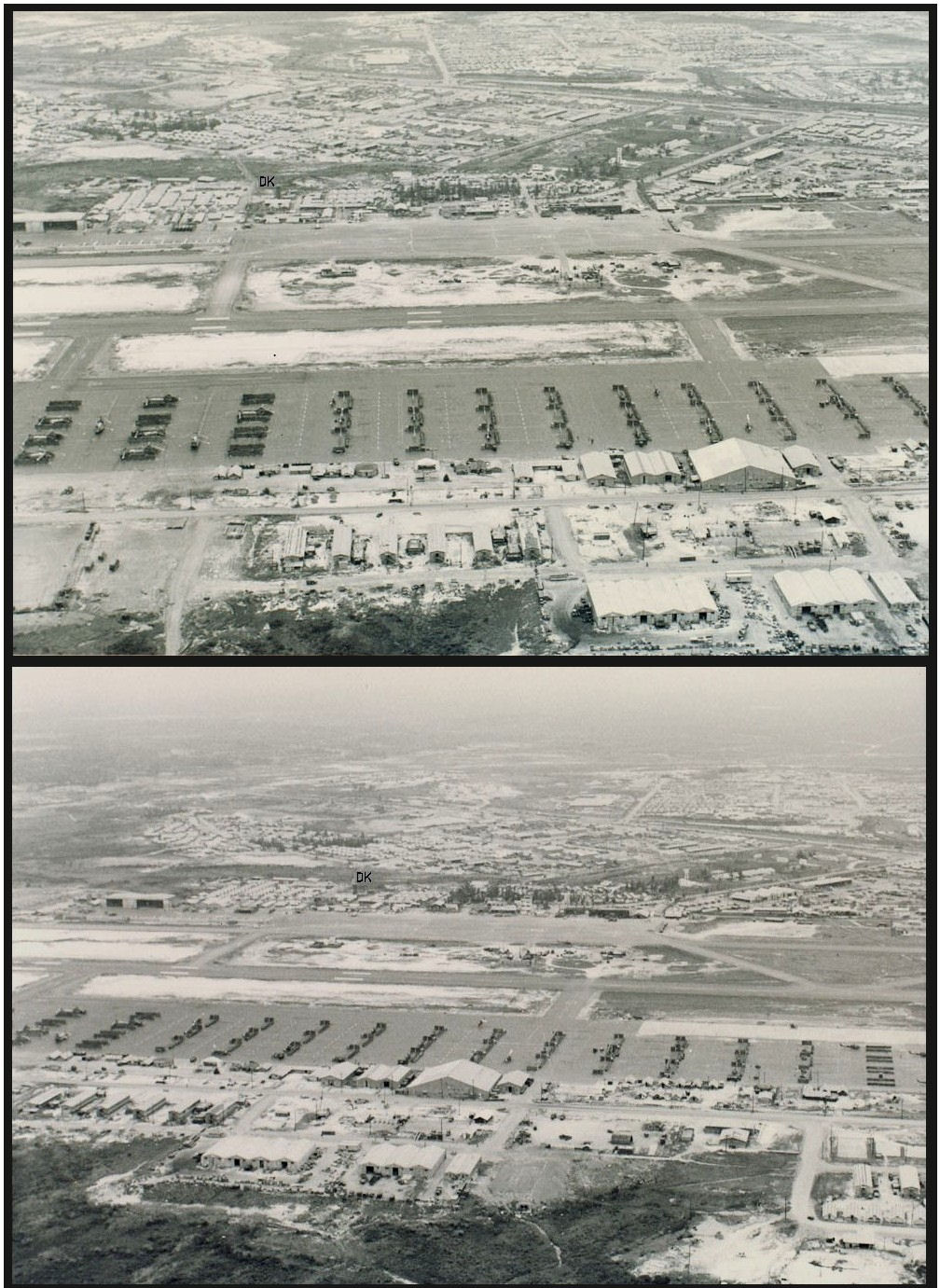
A good wide shot of the Phu Bai airfield looking North from the Control tower walk around Image courtesy of Tom Payne |
Dong Ha airfield set up as a major USAF resupply base for Lam Son 719. Taken looking East from the airfield toward the coast and Quang Tri. (March 1971) Image courtesy of Tom Payne |
Dong Ha airfield looking West. Thank goodness it was the dry season! If it had been the rainy season the field would have been a sea of mud! The area with sleeping hooch and showe/latrine is to the left of the USAF built, Quonset shaped hanger. Interlocking Steel plate parking area is directly in front of the camera. At end the mortar and rocket attacks got so frequent we moved the sleeping hooch into and under the steel reinforced concrete quonset hanger for protection!!! (March 1971) Image courtesy of Tom Payne |
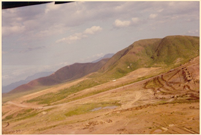
Beautiful view looking North from atop Vo Dat mountain which was North of Xuan Loc in Eastern II Corps. Vo Dat mountain (really a hill) was a horseshoe shaped hill, possibly the remains of a volcano. This was�an area�of III Corps called the "Rice Bowl". A beautiful area (November 1870, Thanksgiving). Image courtesy of Tom Payne |
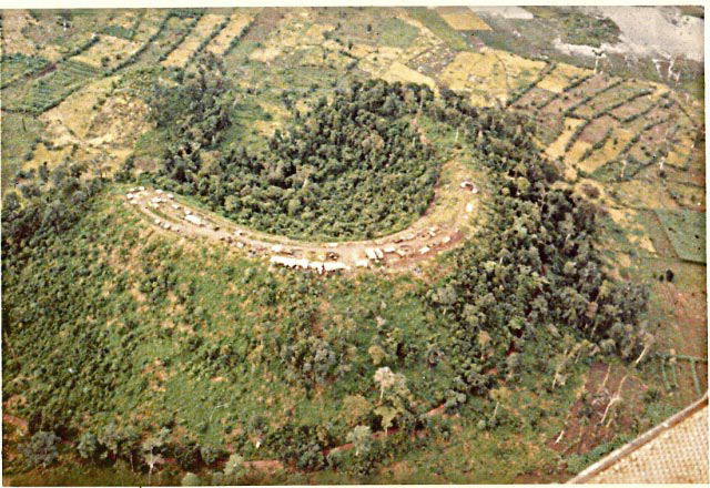
This pic is from FSB Currahee, in the A Shau Valley, summer '69, Operation Montgomery Rendezvous, which was the continuation of Apache Snow which encompassed the north end of the valley. MR included the whole of the A Shau Valley, it lasted longer and was more productive than Apache Snow, but didn't get the same press. It was a tough fight all over the valley but in the end Chuck couldn't take the beating and withdrew. We weren't aware of the controversy Stateside and were very proud to have taken part in such an epic battle. Our guns spent 5mo. on the valley floor at Currahee and we were the very last of the 101st to leave. Image courtesy of Raz� Reed� |
Phan Rang Image courtesy of Steve Shepard |
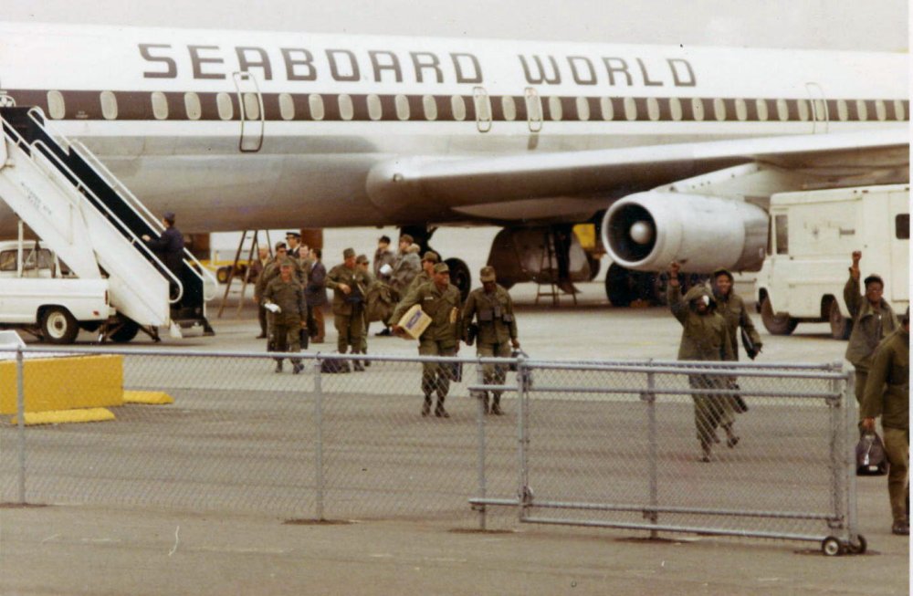
This was my Freedom Bird arrival at San Francisco......Truely a Happy Day Image courtesy of Raz�Reed� |
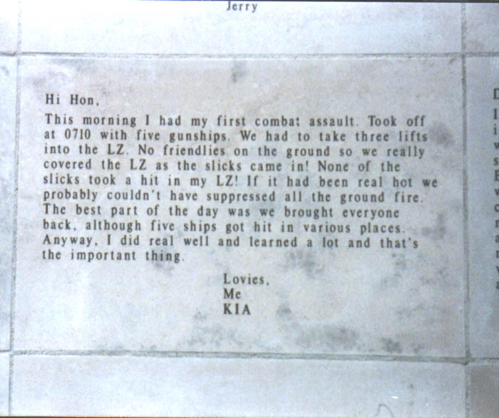
A panel of the State of Ohio veterans Memorial located on the grounds of the state capital. The memorial consists of engraved letters sent home from the combat zones of several wars. This one was obviously written by a Pilot or crewman. The writer is identified as having been Killed in Action (KIA). Image courtesy of Keith Alleger, 117th AHC� |

R&R Special forces Style! While we were at Tay Ninh B-36 held a set of Cambode Olympics. The Photographer kneeling at the far side of the ring was a free lance photographer named Sean Flynn, son of Errol Flynn. I understand he did not survive the war Image courtesy of Keith Alleger, 117th AHC� |
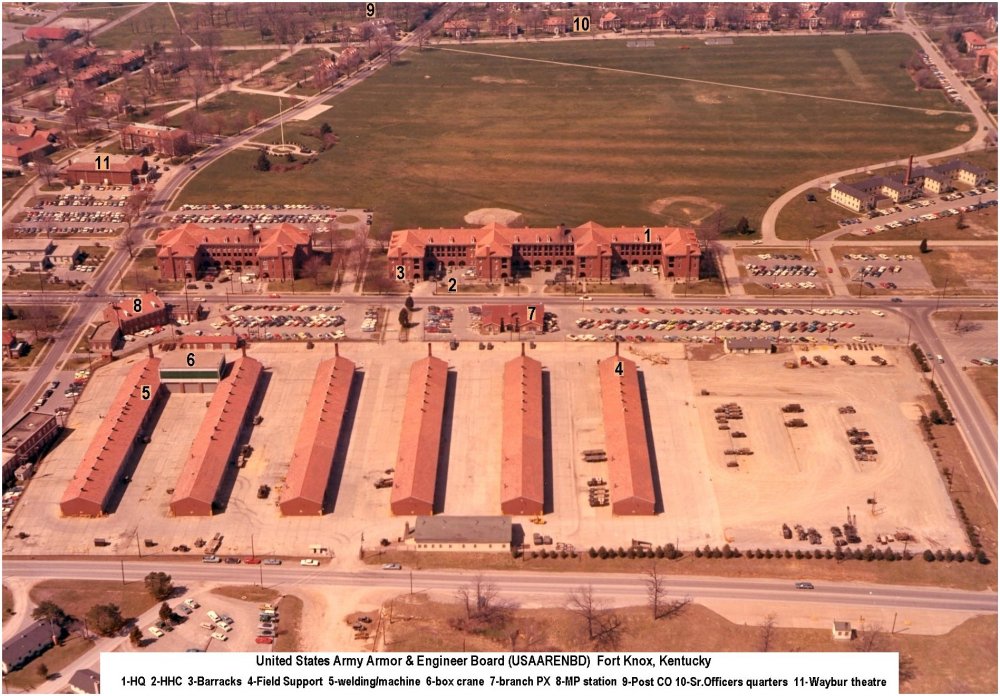
From the 'Home of Cavalry & Armor', the place where so many of those wonderful toys were tested, the former Armor Board at Ft. Knox. It was my privilege to serve here after DEROS. 11th ACR was well represented as two former commanders had senior positions here: MG Donn Starry succeeded MG W. Desobry as Post CO & Armor School commandant was MG G.S.Patton III. The PX & MP station shown were 'violated' one night in '73 by an M60A1 tank driven by a severely PO'd GI hoping to crush some MPs with a vehicle stolen from Boatwright tank depot. He only succeeded in flattening some cars and putting some BIG vents in the walls of both, apart from lodging himself at Leavenworth for a few years. Image courtesy of Col. John P. Berres (ret), President of USAARENBD via Doug Kibbey� |

FSB (Fire Support Base) Birmingham Image courtesy of Jim Newman |

Security car on an armed train, here on the rail line just across QL-1 in Phu Bai '71. Cpt. Larry Vaught & myself were watching this train couple some cars and saw disaster looming when an inattentive crew hit the rest of the train a little hard, sending the mostly ARVN passengers (who were standing leisurely in boxcars), flying past the doors like a cartoon. It wasn't fast enough for anyone to be hurt, and we were immobilized with laughter for several minutes. Image courtesy of Doug Kibbey |
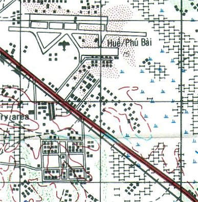
Map of Phu Bai and the active strip. That's highway 1 running at a 45 through the area.� Image courtesy of Randy White |
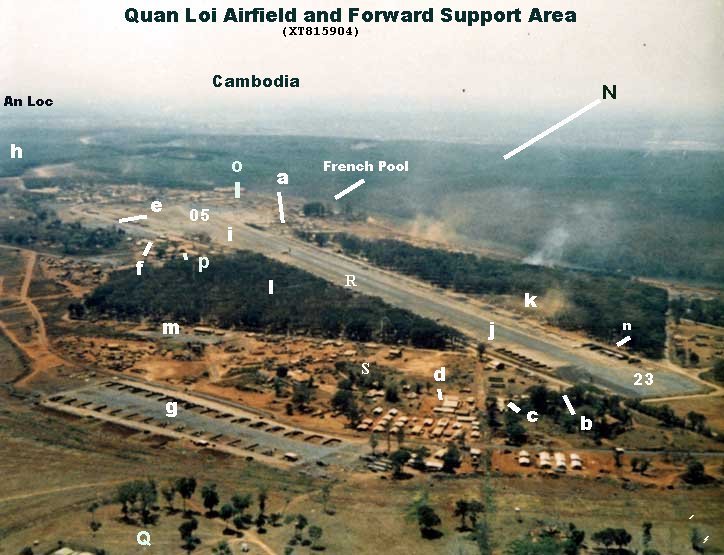
Quan Loi Image courtesy of Robert Geiger |
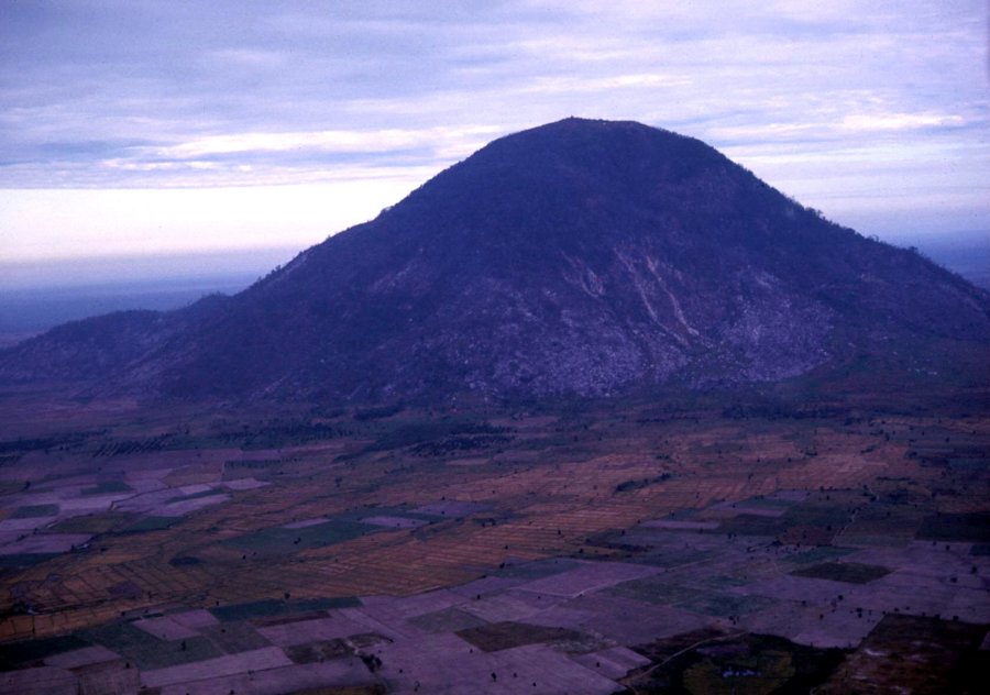
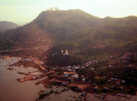
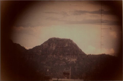
Black Virgin Mountain Image courtesy of Robert Geiger |
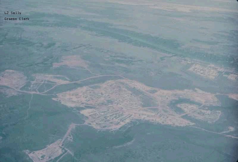
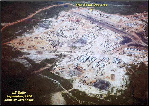
This is a 1968 photo of LZ Sally from about 10,000 feet up in the air.� The top of the picture is pretty much oriented to north.� The A Shau Valley is to the west and the South China Sea to the right of the picture. "I did not get there until spring of '71 so I was never at Sally. When I got there, we were in some quonset huts that had been built by the Marines. We had nice bunks up off the ground, hot running water, a swell mess hall and it was almost like Boy Scouts out on bivouwac somewhere. Even had handball courts the Marines had built. My mother was blown away when I wrote home and requested that she send my handball gloves and stuff!" Rick Schwab Image courtesy of Curt Knapp |
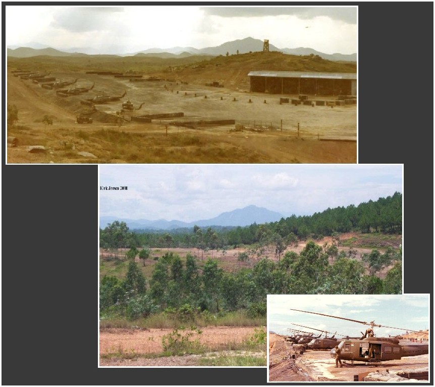
Composite view of 2/17th Camp Eagle flightline looking SSW in 1971 and, thanks to B Trooper ('Banshees') Kirk Jensen's unrelenting efforts, 2001 Image courtesy of Doug Kibbey and Kirk Jensen, 2/17th Cav. |

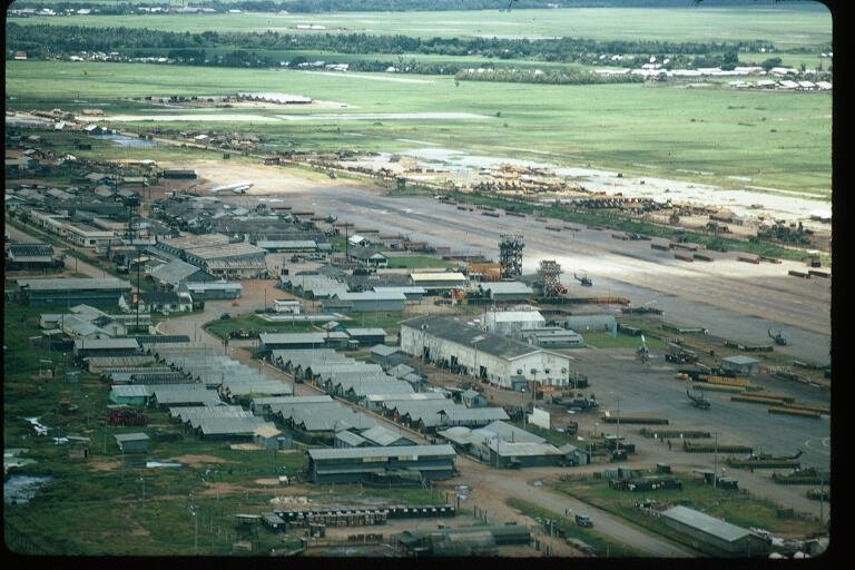
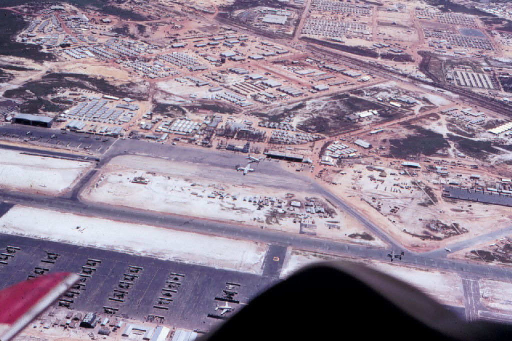
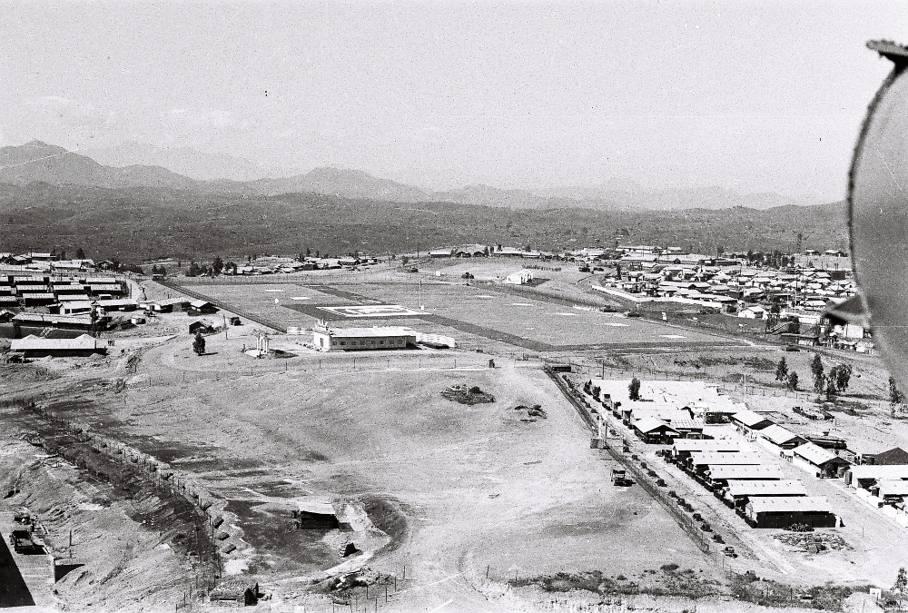
This picture was taken looking due South, �1971 vintage. The runway is the Phu Bai Airstrip. The hangar in the center of the picture is the hangar C Troop, 2/17th Air Cavalry shared with the 4/77th ARA unit.�The South China Sea is to the left of the picture.� Camp Eagle and the 101st Airborne Division HQ would be to the right of the picture (West) as is the highway QL1.�The smaller building immediately to the right of the hangar was the Allied Shops maintenance hangar.� Aircraft hydraulics, electronics, sheet metal repair, cobra and huey engine shop, and OH-6 LOH Maint teams, �worked out of this shop. The 85th Evac Hospital was located on the other side of the runway to the right border of the picture.�The A Shau Valley and Hamburger Hill (Dong AP Bia) would be located about 15 -20 miles from the upper right portion of this picture on a southwesterly heading.�The 5th Transportation Bn�Helicopter Repair facility was located in a hangar to the left of this picture, on the same side of the runway the C Troop 2/17th hangar was located, and at the east end of the runway.� It is not in the view of this picture.��To the right bottom portion of this picture, and outside the Phu Bai Airstrip perimeter wire, was the ARVN Basic Training Camp.� It is not in the view of this picture. Image courtesy of Doug Kibbey |

Camp Eagle, immediately following the Bob Hope 1971 Christmas Show Image courtesy of Rick Schwab, Condor 47 |
|

Recent satellite view of the A Shau valley Image courtesy of Doub Kibbey |
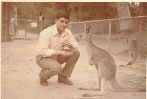
Me�in Sydney Australia 1971 on R&R. I am the one wearing shoes and clothes� Image courtesy of Felix�Bates� |
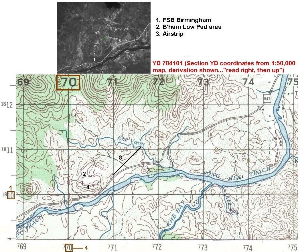
FSB Birmingham, coordinates YD 704101. Following the applied convention for map reading, locate appropriate 1:50,000 map section (in this case, YD) and 'read right, then up', for the nearest numbered box & your best estimate for the box 'fraction' in tenths. No separator between the Right-Up numbers, thus 70 4 for 'right' & 10 1 for 'up' (red boxes & numbers added for clarity). This is how it was done before GPS came on-line... Image courtesy of Doug Kibbey |
Hue Citadel Late '72 Image courtesy of Rich Neely |

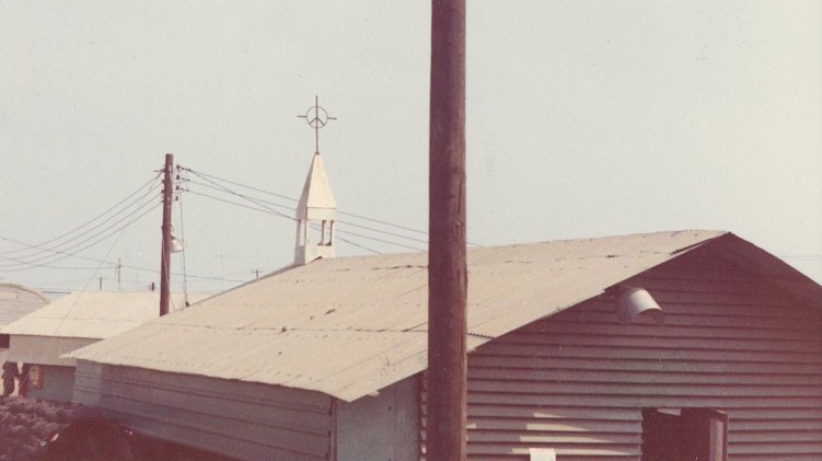
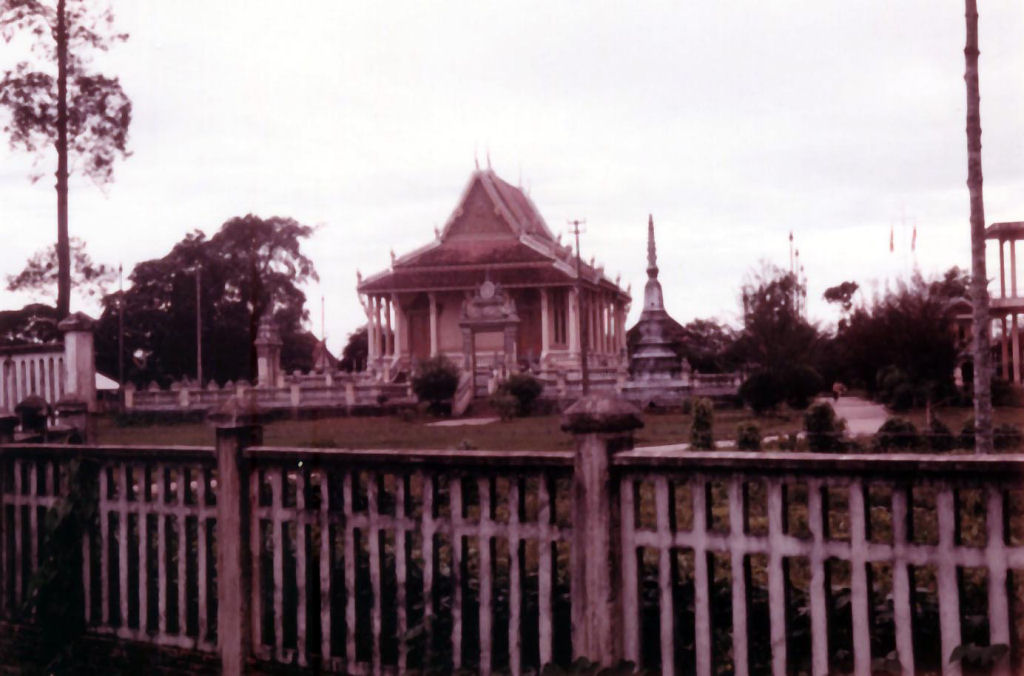
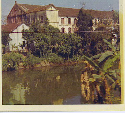
This is a church on the Southwest side of Hue. Late '72 Image courtesy of Rich Neely |
1st Inf Div patch cut in the Jungle Image courtesy of Mike Sloniker� |

Hue-Phu Bai Airport...under new management... Image courtesy of Doug Kibbey |
Here's the airfield at Dak To, South Vietnam. Believe me, it looks a lot prettier from a thousand feet! Serving the "Tri-State Area" of South Vietnam, Cambodia, and Laos, Dak To International offers the weary aviator binding dust in the dry season and bottomless mud during the monsoon. For the sports-minded, there are numerous NVA and Main Force Viet Cong units conveniently located throughout the surrounding countryside for your shooting pleasure. During the peak tourist season accomodations are very limited, so bring your own tent or poncho. Dinining is also somewhat limited, with C-rations being the cuisine of choice, though a tasty monkey or dog stew can be had at the Montagnard village next to the river. Warm beer and a friendly game of poker are always available in the Falcons tent, so plan on adding Dak To to your "must visit" list Image courtesy of Tillman Jeffrey |
Dak To Air Strip Image courtesy of Tillman Jeffrey |
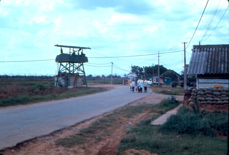
This is QL-1, the main highway running north to south. �This section is way up north near LZ Sally. �August 72 Image courtesy of Rich Neely, D Trp, 17th Cav, Danang |
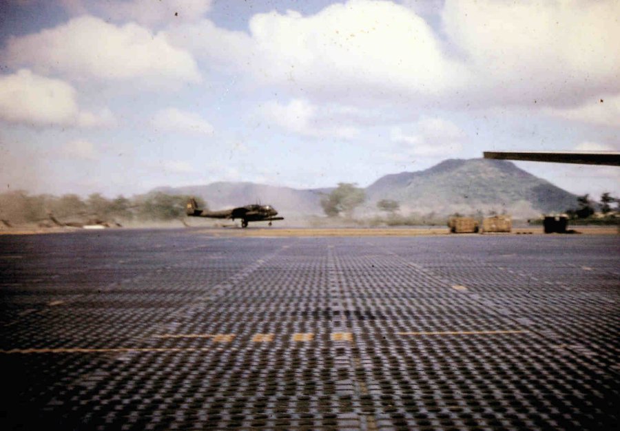
Parking Ramp, An-Khe army airfield November 1965. Several types of aircraft roughly dispersed, with minimal base facilities on offer. Various aircraft shown are U8, 0-1, CV2 and UH1 variations. Of particular interest is the Airforce C-123 ' White Whale' the personal aircraft of General Westmoreland. Image courtesy of Joe White via John Jones |
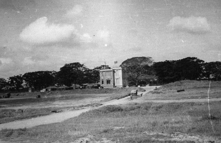
This one for places and bases. An Khe Airfield November 1965, old french Villa used as makeshift control tower and command post. Note the G.P. Tents and road clearing still in progress. Image courtesy of Joe White via John Jones |
An Khe Army Airfield, September 1965. 2 Huey slicks of the 229th AHB, find landing space on a partly cleared area of the ' Golf course' landing strip. In the background, a chinook helicoptor of the 228th ASHB overflies a row of its Battalion ships, awaiting their loads. Image courtesy of Joe White, Via John Jones |
An Khe 1971 Cav landing strip. Nice comparison of the French Villia as it was 6 years later. Will have to bow to your knowledge of what Cav unit this ship is from, they supported ' C/75 'charlie Rangers' Image courtesy of Frank Benns |
The 2nd Brigade Aviation Section of the 101st ABN DIV at Sally. Image courtesy of Curt Knapp |

Image courtesy of Jan Null |
Soc Trang Image courtesy of Jan Null |
Soc Trang Image courtesy of Jan Null |
Soc Trang Image courtesy of Jan Null |
Short final approach to Vung Tao Image courtesy of Chip Decker |
Vung Tao Airbase Image courtesy of Chip Decker |
Bone yard off the end of Siagon airfield. Image courtesy of Chip Decker |
Quon Loi Image courtesy of Robert Hraban |
This is Vung Tau on the coast south of Nha Trang and it was an area that the U.S. Navy operated out of. Image courtesy of Bob Peneguy |
Approaching the pad, revetments and quarters at Avn Det, HHC, 196th Inf Bde. First, "Freedom Hill", the out-processing area for I Corps. Billets for the troops in the fore-ground. Amphitheater, center upper, is where Bob Hope did his Christmas shows. Image courtesy of David Ayers |

Final approach to the pad. Bde HQ on the hill. Image courtesy of David Ayers |
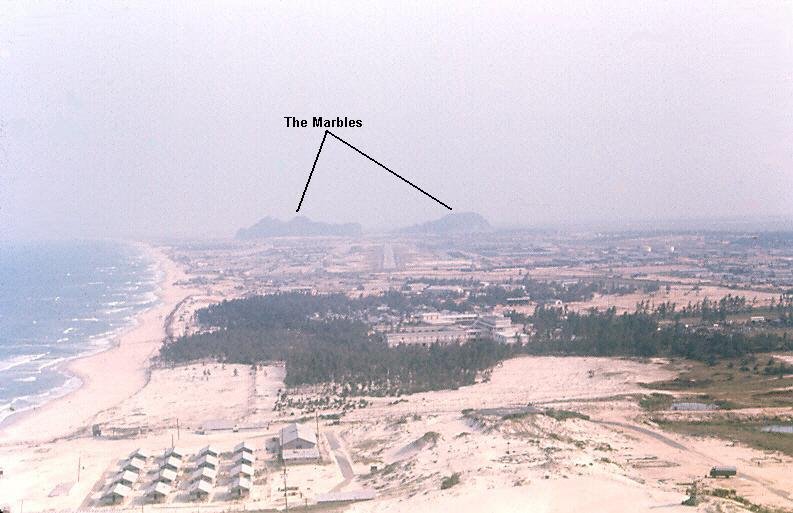
Approaching Marble Mountain Army Airfield from the north. Image courtesy of David Ayers |
One of the "marbles" up-close Image courtesy of David Ayers |
Another of the "marbles" up-close Image courtesy of David Ayers |
Panoramic composite of Phu Bai airfield ca. 1965 as taken from various points around the tower, viewing west-north-east, L-R. Image taken by John Phillips, 3rd RRU - Phu Bai, Viet Nam via Doug Kibbey - NOTE - (John would very much like to contact Gary Roger Heatherington. If whereabouts known, please contact webmaster). |

Photo of the the 145th CAB area at Bien Hoa Air Base 1968 from the 145th CAB Photo history book vol 2, page 3 Image courtesy of Dave Green 68th AHC crew chief |

Hue Airfield Helipad (Lift Master Pad) (1969). The helipad was used by the Hawks from D/101 AWC, the Black Widows C/101, and Lift Master the Chinook unit. Image courtesy of Chip Decker |
Another shot of Lift Master pad near Hue Airfield (1969). Image courtesy of Chip Decker |
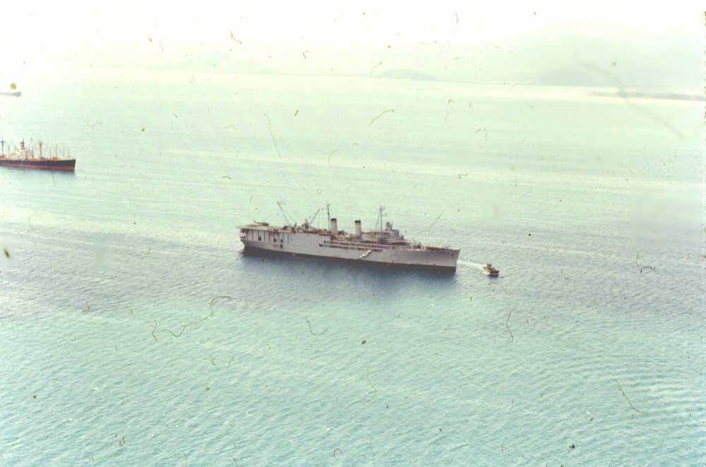
The USNS Corpus Christi Bay Helicopter maintenance ship near Cam Rhan Bay (1967). Image courtesy of Chip Decker |
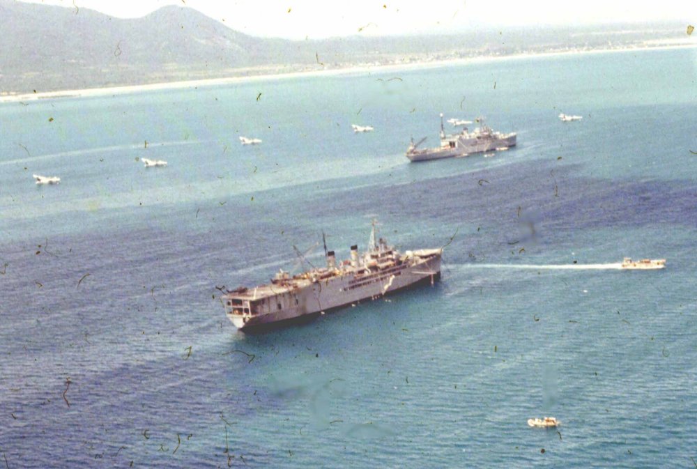
The USNS Corpus Christi Bay Helicopter maintenance ship near Cam Rhan Bay (1967). Image courtesy of Chip Decker |
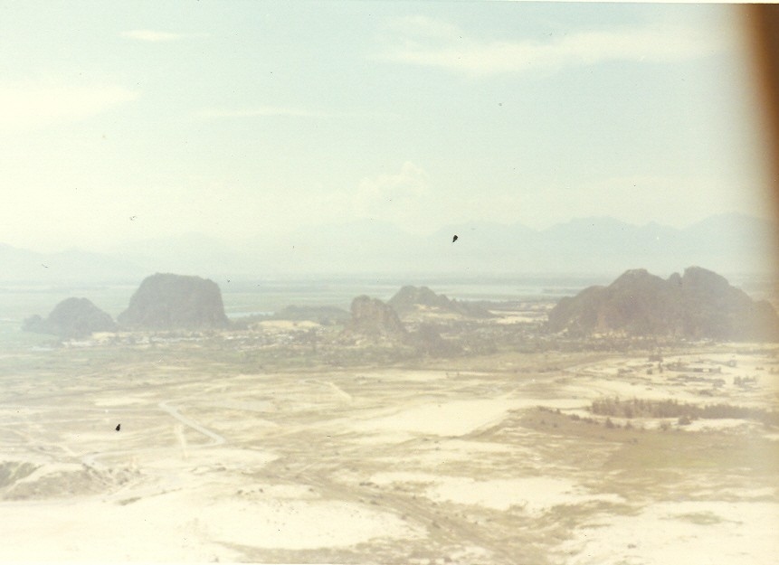
Image courtesy of Roger Grasman |
Panoramic of two exposures from Phu Bai North, view to SW. Dong Truoi Mt. at the left, southern bit of Hill 180 ridgeline at the right. Image courtesy of Doug Kibbey |

Approach in-country to Cam Ranh Bay on Flying Tiger Airlines-1971. Image courtesy of Doug Kibbey |
City near Soc Trang Image courtesy of George Quackenbush |
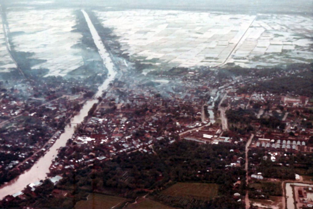
River town near Soc Trang Image courtesy of George Quackenbush |
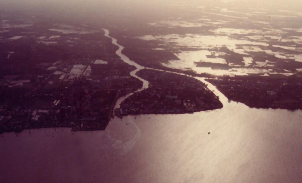
River Mouth Image courtesy of George Quackenbush |
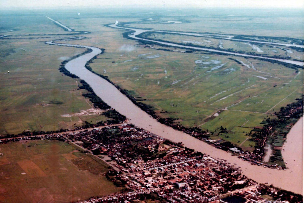
River Junction Image courtesy of George Quackenbush |
Prison port Image courtesy of George Quackenbush |
Pagoda Image courtesy of George Quackenbush |
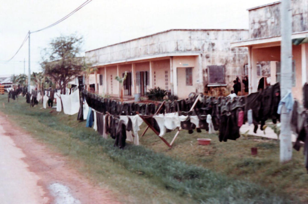
Wash day at Soc Trangsm.jpg Image courtesy of George Quackenbush |
View of Camp Eagle North Perimeter Image courtesy of Richard Bullen via Doug Kibbey |
Phu Bai airport, view from west to east, terminal in center. Image courtesy of Richard Bullen via Doug Kibbey |
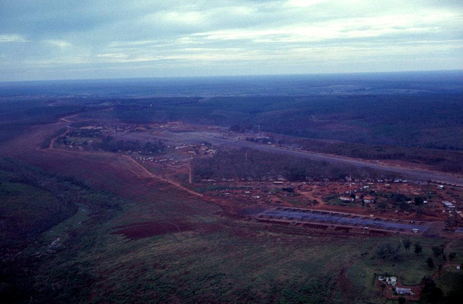
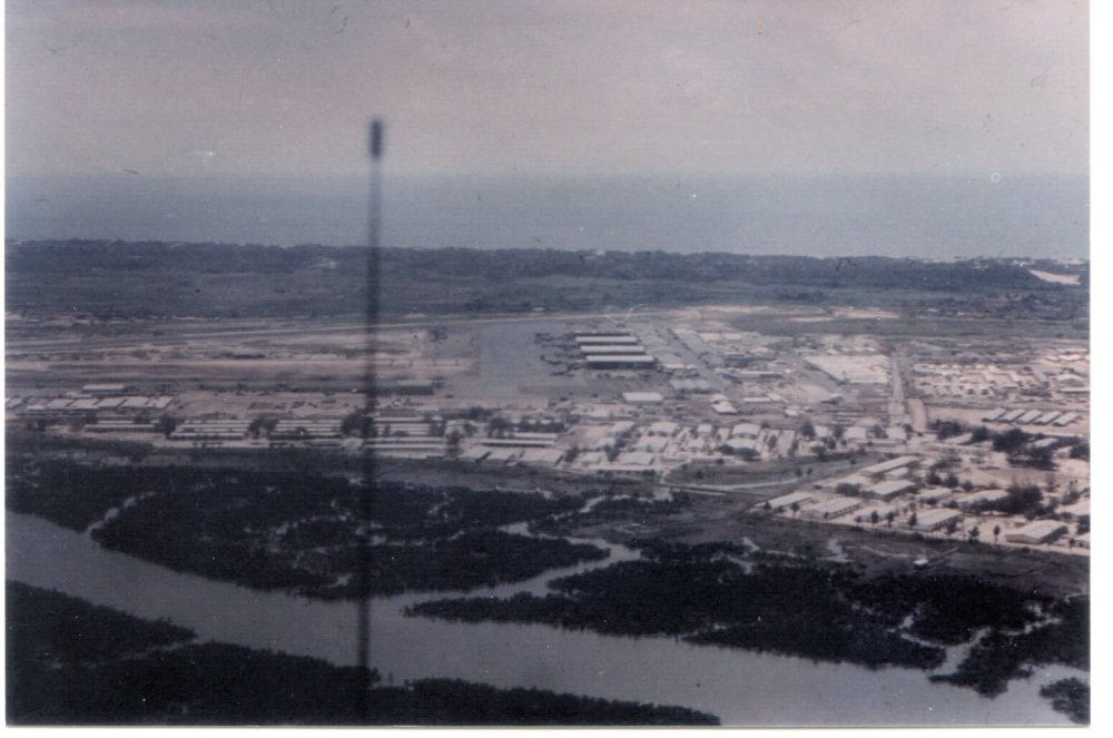
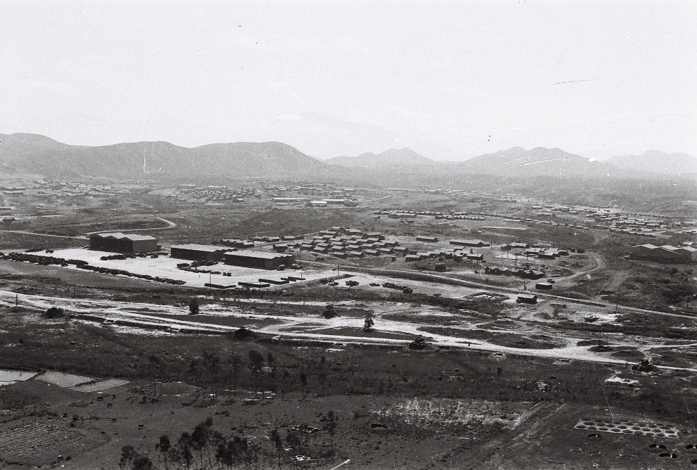
View between Camp Eagle and Phu Bai. Image courtesy of Richard Bullen via Doug Kibbey |
Soc Trang front gate. Image courtesy of Forrest Webb |
Soc Trang - view from front gate looking back at the base. Image courtesy of Forrest Webb |
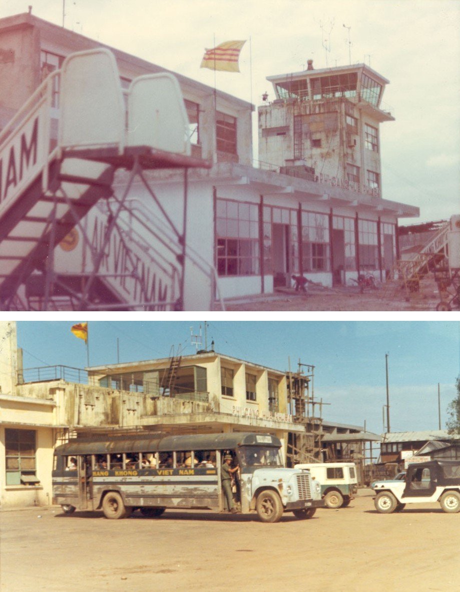
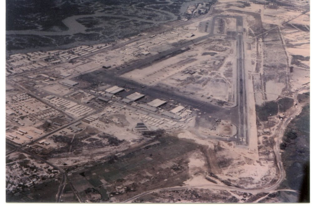
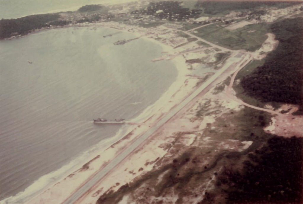
Phu Bai International Airport Fall of 1968. Image courtesy of Ray Knight |
Phu Bai International Airport. Image courtesy of Doug Kibbey |
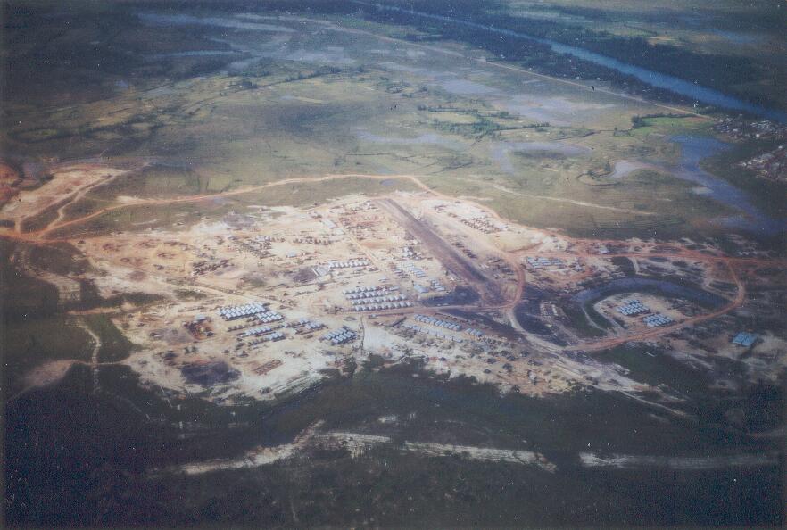
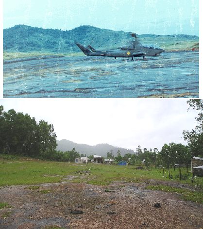
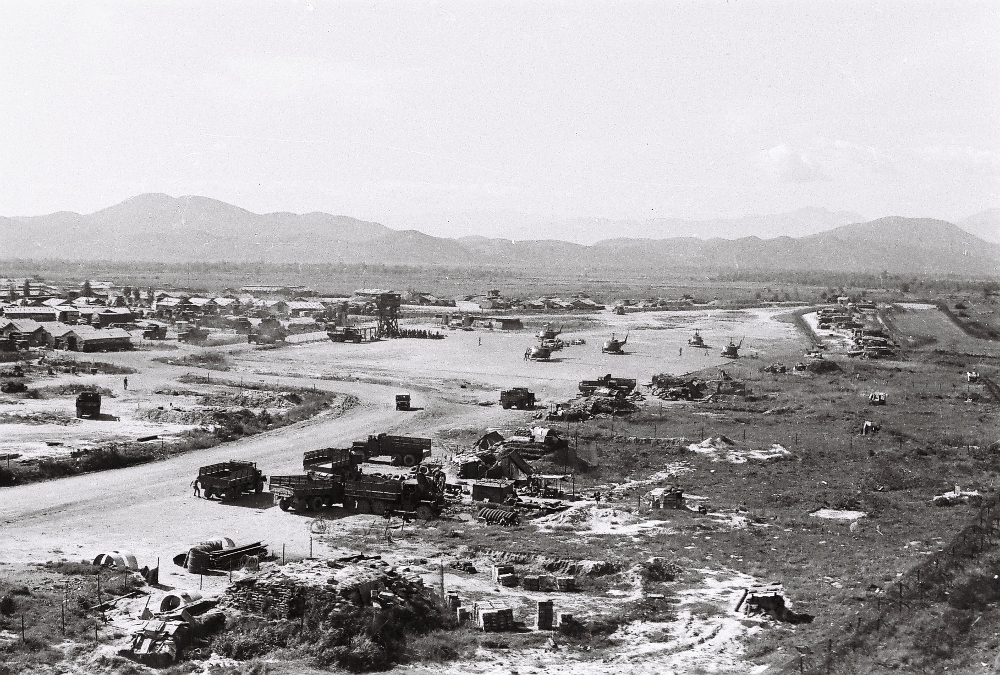
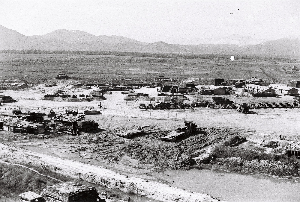
FSB Birmingham 3,000' airstrip view toward the East. Prep for CA by Smokey Stover (top), as viewed from same point in March 2005. Image courtesy of Doug Kibbey |
View to NE from site of former north low pad 2005 and same view from a point about 300 meters further west in '71 while I was with D Troop, 2/17th Cav. This is a monument in a grove of trees that sits on the north side of the old pad just north of the airstrip. It commemorates the ~600 NVA dead in graves there (visible) who mostly perished in the Spring Offensive-'72. In the composite pic from the hill looking down on the village elsewhere on this page, this grove is visible to the left of the bare area that had been the North Pad. Image courtesy of Doug Kibbey |
North Pad view to the East in a Steve Nirk pic (top) and in 2005. The airstrip in to the right and the monument/NVA graves to the left. Image courtesy of Doug Kibbey |

This is the North Pad looking toward the Firebase, just to the north of the airstrip. You can see PSP scars in the thin asphalt that remains. This is just south of the monument/cemetary to war dead. Image courtesy of Doug Kibbey |
Classroom built on the B'Ham airstrip. On this occasion, the children had just let out and the classroom was being used so a local farmer could teach city dwellers how to better care for any animals they own. Image courtesy of Doug Kibbey |
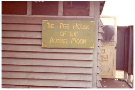
Troops manifesting out in the later years had to pass a urinanalysis for drugs and passed through this familiar portal, a pun on the film titled "Teahouse of the August Moon", located in Long Binh. Since "cheating" was a possibility, there were observers to make sure it was your own pee going in the cup...those with this unenviable task were known as "pecker checkers". Image courtesy of Roger Justison via Doug Kibbey |
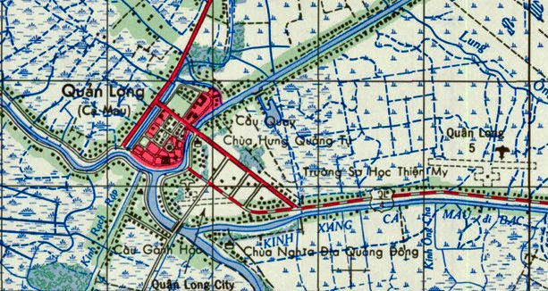
Ca Mau (Quan Long) AAF Image courtesy of Eric Bray |
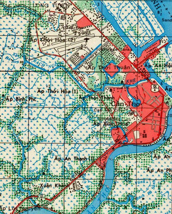
Can Tho AAF Image courtesy of Eric Bray |
|
Can Tho AAF Image courtesy of Eric Bray |
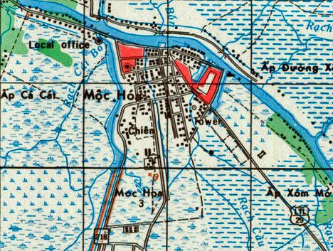
Moc Hoa AAF Image courtesy of Eric Bray |
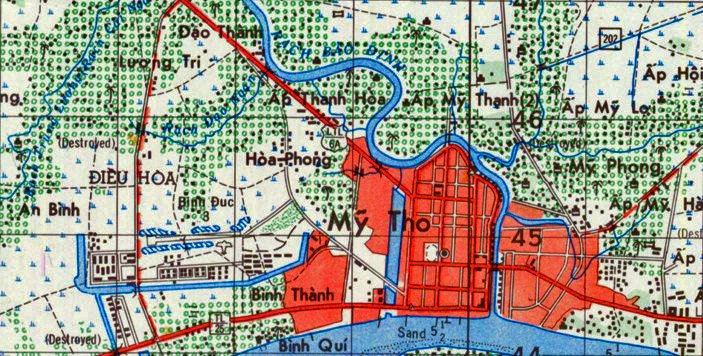
My Tho AAF Image courtesy of Eric Bray |
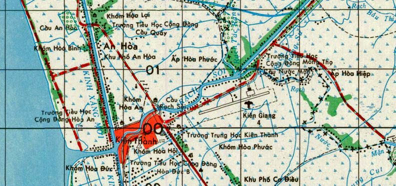
Rach Gia AAF Image courtesy of Eric Bray |
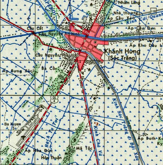
Soc Trang (Khanh Hung) Image courtesy of Eric Bray |

Early photo of Da Nang Tower Image courtesy of Don Hauschild |
Marble Mountain taken at night with Role camera and starlight scope Image courtesy of Don Hauschild |
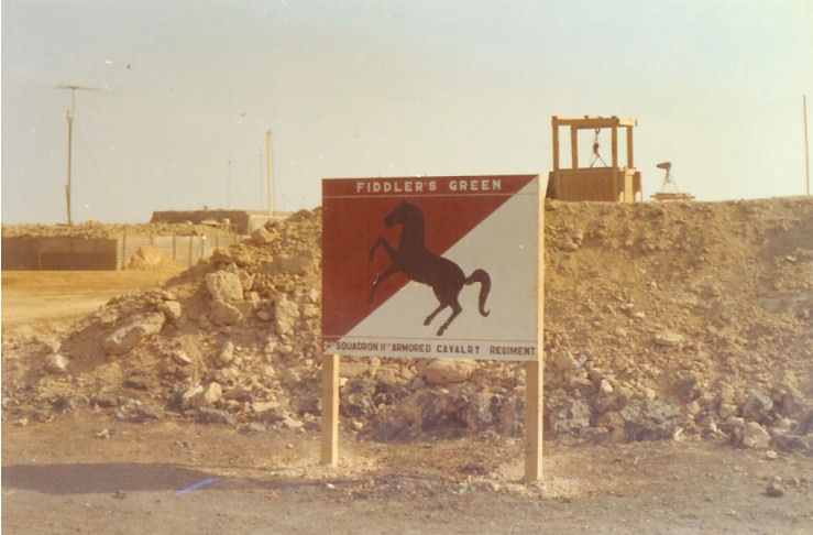
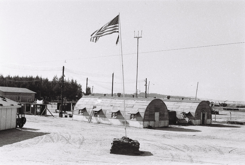
FiddlersGreenSign.jpg: "Sign at entrance to one of the last U.S. firebases constructed, FSB Fiddler's Green in III Corps, operational home to 2/11th ACR and it's Howitzer Battery in their last days in the field, Jan.-March '72. Details of this base viewable elsewhere on this page. Image courtesy of Steve Shannon via Doug Kibbey |
A photo I took of Vo Dat mountain while returning from the 125th A.T.C. base camp in Bien Hoa some time in early Nov. 1970. Image courtesy of Sam Weaver (SP-5) C Company, 125th ATC Battalion Vo dat MT. 9/70 thru 12/70 |

Cam Ranh Bay US Army replacement depot which was the first point of arrival for new troops awaiting assignments in the RVN. Images courtesy of Tom Kehoe |
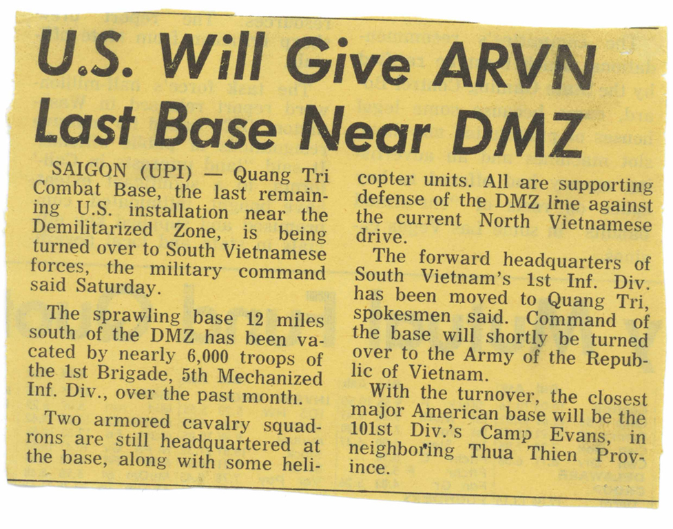
Image courtesy of Tom Kehoe |
|
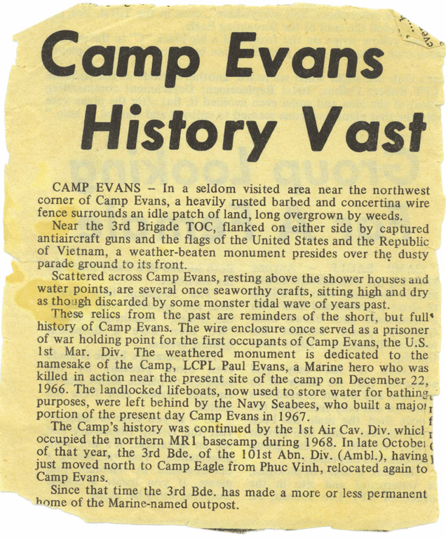
Image courtesy of Tom Kehoe |
These pictures of the Hue Citadel were taken from the front, gunner's seat of a cobra from D-158-101st Abn Div, 1970 Images courtesy of Tom Kehoe |
|

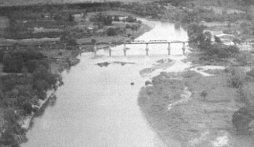
Various views along the bank of the Perfume River flowing through Hue Images courtesy of Tom Kehoe |
||
Soc Trang Airfield from the air Image courtesy of Milton Lowden 121st AHC |
The Road to Soc Trang from the Base Image courtesy of Milton Lowden 121st AHC |
Image courtesy of Greg Windsor - 240th AHC |
Tan My from the air Courtesy of Wayne Moose, F/4 scout gunner 1972/73 Via Brain Harrison |
F/4 Tan My company area. Image courtesy of Brian "Stretch" Harrison, F/4 Cav |
|
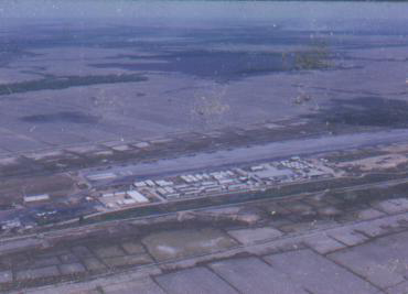
LZ Sally I Corp from the air late 1972. Image courtesy of Brian "Stretch" Harrison, F/4 Cav |
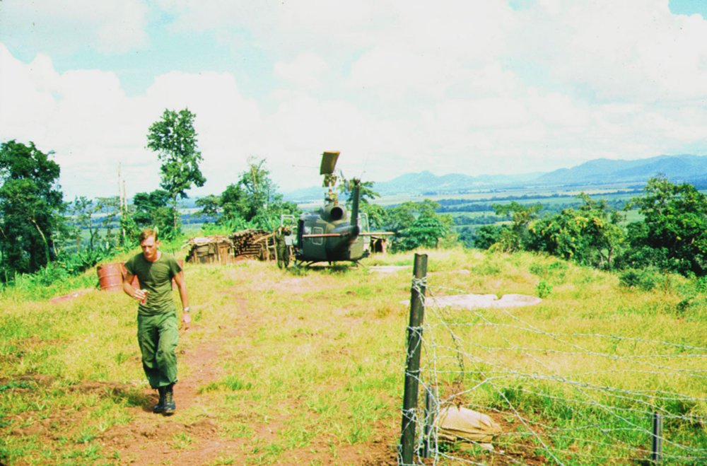
This is a firebase located west of Camp Eagle, I Corps, in the mountains overlooking the A Shau Valley. I'm in a UH-1 taking the picture of another unit's huey making an approach to the landing pad. The landing pad is that small square of PSP (pierced steel plating) in the front edge (facing us) of the fire base. You can see that "smoke was popped" so the pilot could judge which way the wind was blowing. When we took off at sea level overloaded, which was common, we had to approach almost level with the pad; using a shallow glide slope, so we wouldn't fall through the landing and over torque the transmission. Over torquing the transmission irritated the crew chief a-whole-lot. Image courtesy of Pete Rzeminski, CW2, 1st Bde, 101st Abn, 68-69 |
|
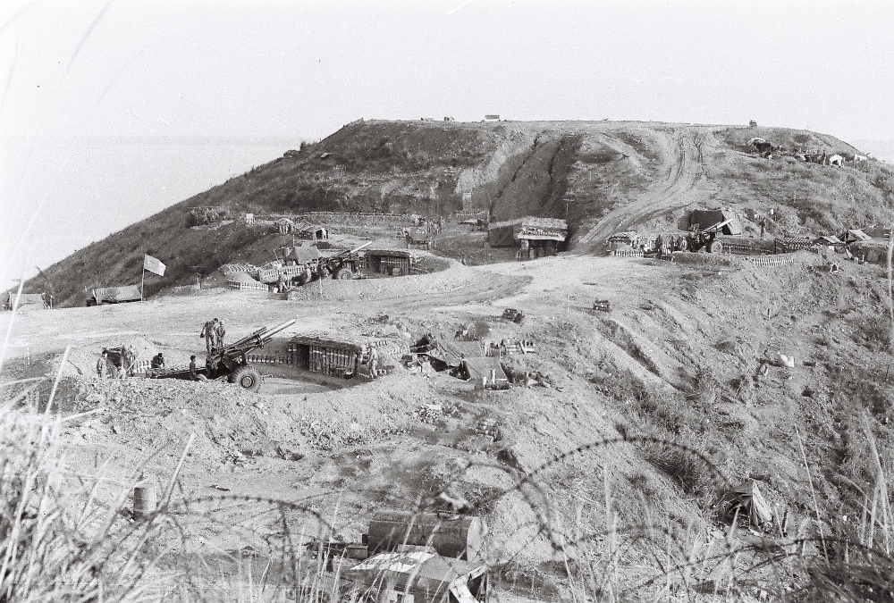

Firebase T-Bone as it looked in late 1972. Note the American advisers working with the ARVN artillery men. Image courtesy of Brian Harrison |
||
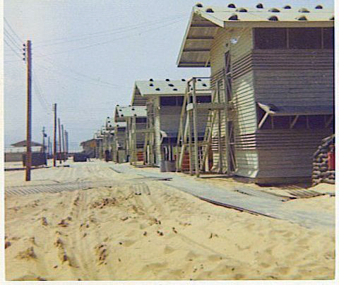
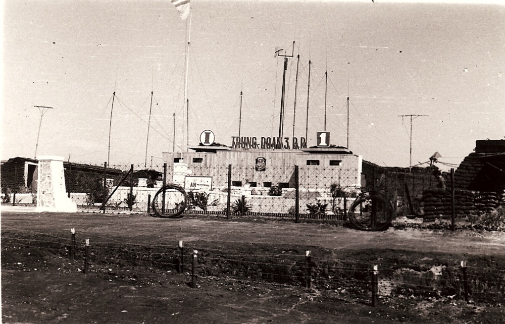
Views of Camp Eagle, late 1972. By this time Eagle was manned by the South Vietnamese Airborne. Courtesy of Brain Harrison, F troop, 4th Cav |
Views of Camp Eagle, late 1972. By this time Eagle was manned by the South Vietnamese Airborne. Courtesy of Brain Harrison, F troop, 4th Cav |
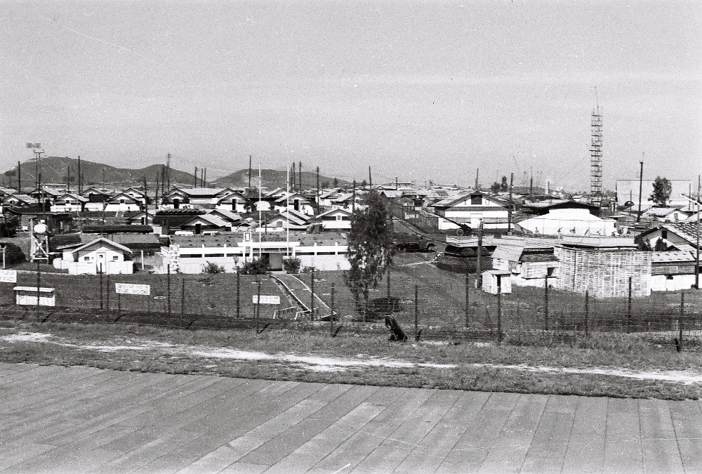
Views of Camp Eagle, late 1972. By this time Eagle was manned by the South Vietnamese Airborne. Courtesy of Brain Harrison, F troop, 4th Cav |

Views of Camp Eagle, late 1972. By this time Eagle was manned by the South Vietnamese Airborne. Courtesy of Wayne Moose, F troop, 4th Cav |
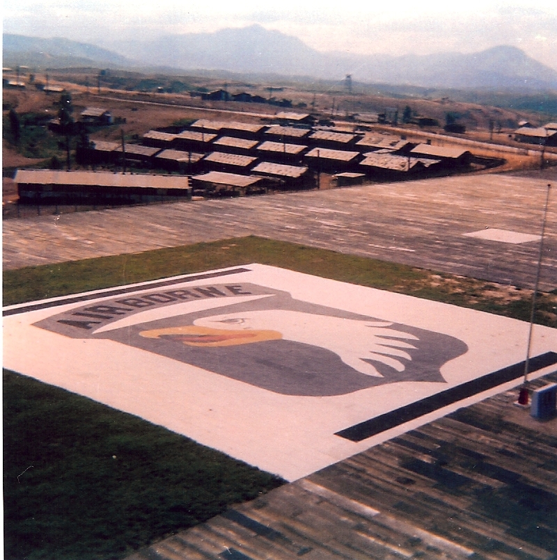
Views of Camp Eagle, late 1972. By this time Eagle was manned by the South Vietnamese Airborne. Courtesy of Wayne Moose, F troop, 4th Cav |
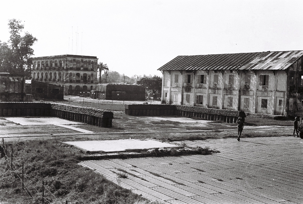
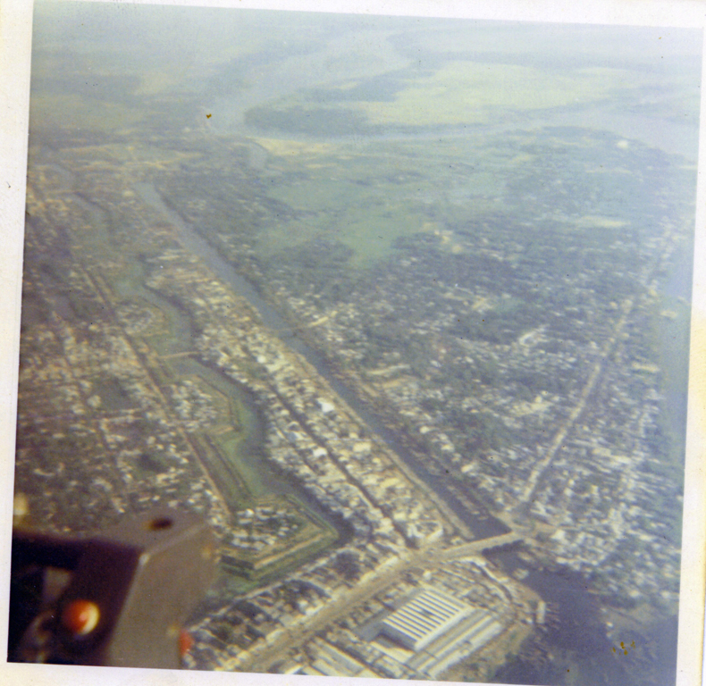
ARVN headquarters landing pad, Hue late 1972. Courtesy of Brain Harrison, F troop, 4th Cav |
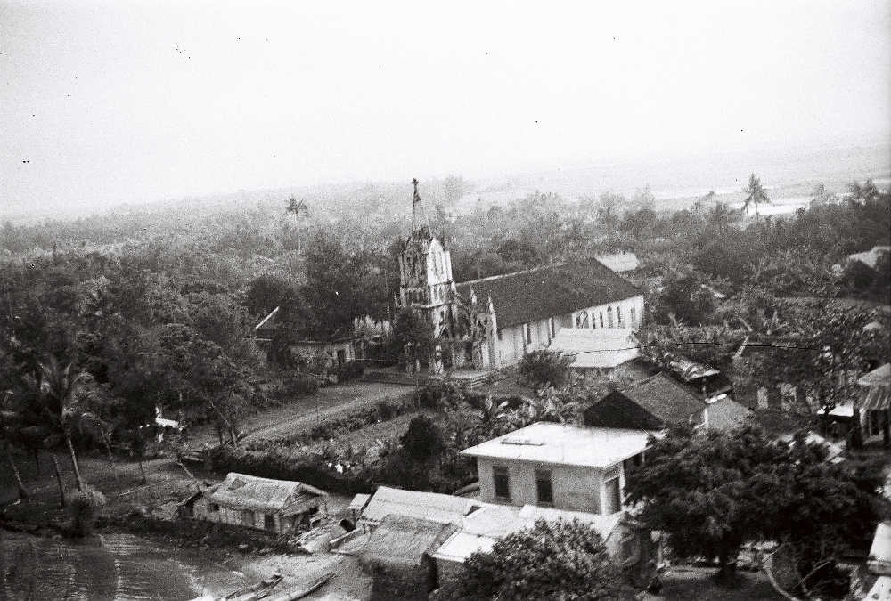
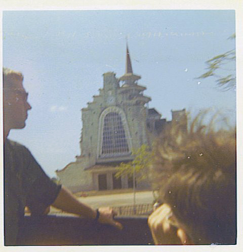
Hue church. Courtesy of Brain Harrison, F troop, 4th Cav |
||
All images remain the personal property of this site and the contributor of the photo. You may download them for your personal use but they may not be published or used on any other site without written permission from the webmaster and the contributor.